
 Anchor Alarm
Merconi — marine life and ocean exploration
Merconi is AnchorQueen's exploration mode: a chart tuned to the living sea
— dive sites, marine-life sightings, ocean conditions, and fishing activity.
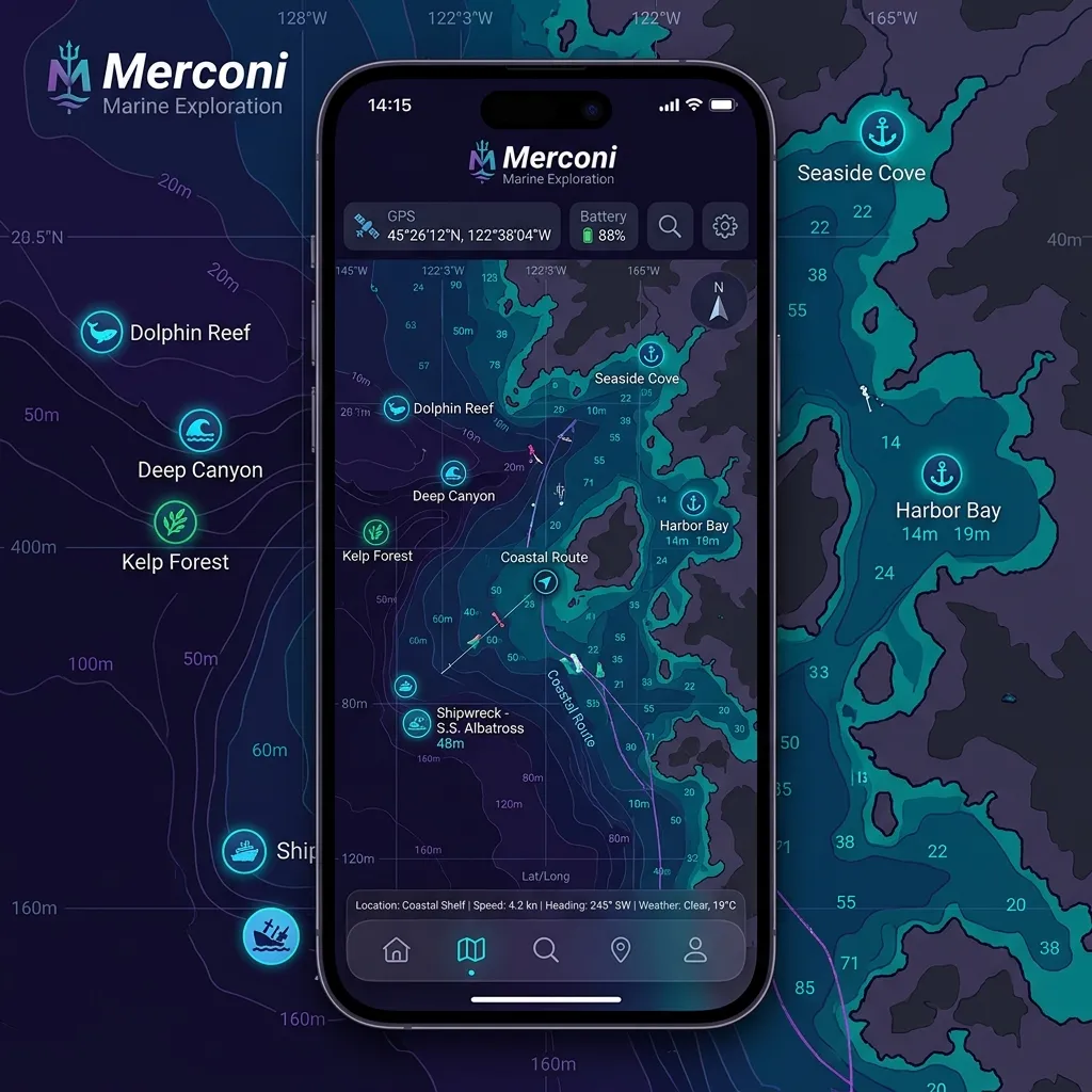
What changes
When you enter Merconi:
over whatever chart style you were already using — it does not force a
style of its own. (If you want the teal Reverse · Merconi Reef
Guardian depth palette, pick it yourself; see [Reef Guardian
palette](#reef-guardian).)
sites, Global Fishing Watch, and ocean data are live the moment you
enter the tab, whichever sub-mode you're in. When you leave Merconi
they all switch off again, so no exploration pins or heatmaps linger
on your other charts.
Diving — Discover — two lenses on the same fully-loaded chart.
(The Anchorage lens moved to the SafeAnchor tab in 2.4.4 as
History — your own past anchorages on a
timeline. Seamark anchorages are still a chart layer and a rail cell.)
The floating legend panels these layers open (Marine Life, Dive Sites,
Fishing Activity, Ocean Data) share the standard chart panel card — drag the
header to move, drag the bottom-right grip to resize, minimize (–) or close
(✕) from the header — see the chart page.
Diving
The diver-facing lens — use it when you are scouting a snorkel spot or
planning a dive day. Dive sites and marine-life pins are the stars
here (they are on in every sub-mode, like all exploration layers).
and short description (from Wikipedia), the common and scientific names,
an IUCN conservation badge where known, taxonomy, the observation record,
and a Resources section with Wikipedia, FishBase, and WoRMS
links that open inside the app (no bounce out to Safari). See
[where this data comes from](#technical-engine).
thumbnail. Use the target button on a row to fly the chart to that
sighting (zoomed in and centred); the fish button opens its FishBase
page in-app. Tap the row itself to open the full detail sheet.
a numbered group bubble. When a survey station reports many species at
the same coordinates, the pins fan out in a small spiral around the
spot (a few hundred metres at most) so each one stays tappable — the
detail sheet always shows the record's true coordinates.
source has, you'll see:
water temperature, and current strength.
hours, and a website link.
Captain's Mark pin toggle.
region — a quiet spot may have only a name and coordinates.
Discover (default)
The Merconi default. Discover centres on ocean-data points — sea
conditions sampled across the chart — alongside the always-on article
capsule for underwater geography and biodiversity.
come from the Copernicus Marine Service — see [where this data comes
from](#technical-engine).
Fishing
Overlays a Global Fishing Watch effort heatmap on top of your chart.
The heatmap is shown only while the Fishing lens is selected — pick a
different Merconi lens (Diving / Discover) or leave the tab and it hides
automatically. There is no separate layer switch for it in Layer Control;
selecting the Fishing pill is the switch.
more fishing hours.
6M · 1Y. This sets how far back the effort is summed — it is not a
vessel-type filter.
(the vessel's country) with an hours-and-vessels bar chart, ranked by
fishing hours. You can recolour any flag's cells.
one-tap zoom-to-tiles when you're outside that range. Opening the Merconi
tab keeps your current chart view — it never zooms the camera out on you.
are working.
> The fishing overlay needs a free Global Fishing Watch API token to
> be configured in the app. Without one, the panel shows an "API Key
> Required" state and no heatmap — see [If something goes
wrong](#if-something-goes-wrong).
Your own log — catches and berths
Merconi isn't only other people's data. Press and hold anywhere on the
chart in Merconi and the command fan offers two entries of your own:
so next season you know which one to take.
Both open the same short form:
library. They are downscaled and stored on the device.
berth. Optional.
Save and the entry drops on the chart as a small tinted pin — amber with
a fish for a catch, blue with a boat for a berth. A pin carrying more
than one photo shows a count badge. Tap it to open the entry: swipe through
the photo gallery, read the note, or use the ⋯ menu to Edit the
title and note or Delete it. The + in the entry's header adds more
photos later.
> These entries stay on your device. Nothing is uploaded, shared, or
synced — deleting an entry removes its photos from the device too.
Where Merconi's data comes from
Merconi's exploration layers are live, networked services — it queries
public marine databases on demand and caches the results per region to
disk so a spot you've already viewed still loads when you're offline. None
of these layers is bundled or pre-computed on the device; an empty layer
usually means no network or no records for that area, not a bug.
Marine life — OBIS + WoRMS
species occurrence pins. AnchorQueen queries the live OBIS web API for
records inside the visible region (no account needed) and caches each
region to disk. Tapping a pin shows the species, where and when it was
recorded, and a link to the source record.
common (vernacular) names in many languages, an IUCN Red List
conservation badge where one exists, a rough maximum size, an
alien/invasive flag, and — for fish — a link to its FishBase page.
Fishing effort — Global Fishing Watch
The Fishing sub-mode overlays a commercial fishing-effort heatmap from
Global Fishing Watch (GFW), rendered as raster (PNG) tiles streamed
straight onto the chart — not vector contours drawn on the device. Effort
is summed over the time window you choose and broken down by the vessel's
flag state (country). This layer requires a free GFW API token to
be configured; without one it stays empty and the panel shows an "API Key
Required" notice.
Ocean conditions — Copernicus Marine Service
Discover's ocean-data layer streams high-resolution ocean grids from the
Copernicus Marine Service (CMEMS), fetched on demand for the visible
area. The underlying model publishes 6-hourly time steps (not minute-
by-minute), so values update on that cadence. Layers include sea surface
temperature, currents (speed and direction), and related fields useful for
drift diving and route planning.
Step-by-Step Exploration Guidance
Planning a Dive Day
Avoiding Active Fishing Zones
Reef Guardian palette
Reef Guardian is a teal-and-cyan depth palette, not a base map and
not something Merconi turns on for you. If you want it, open the [Chart
Layers panel](chart.html#layers) and choose Reverse · Merconi Reef
Guardian under the depth-palette picker. It pairs the inverted-luminance
soundings with bright shallow water, which reads well over coastal dive
areas. Because it's a normal palette choice, it sticks until you change it
back — in any tab, not just Merconi.
Tips
and a clear sea state make a real difference for diving or fishing.
curious starting point, not a guarantee.
If something goes wrong
Fishing Watch needs a free API token configured in the app. Until
one is added, the effort layer can't load; register at
globalfishingwatch.org to obtain a token.
(7D / 30D), check you're between roughly zoom 2 and 12 (use the panel's
zoom-to-tiles button), and confirm you have a network connection — the
tiles stream live.
services. With no network connection, regions you haven't visited
before come back empty; a region you've already loaded is served from
the on-device cache. Move on or zoom back to a cached area.
sites are sparser in some areas; zoom out for context.