
 Anchor Alarm
Cannes Yachting Festival 2026 · 8–13 September · Live Special
Before you take a berth at Vieux Port or Port Canto, see the water you are arriving into.
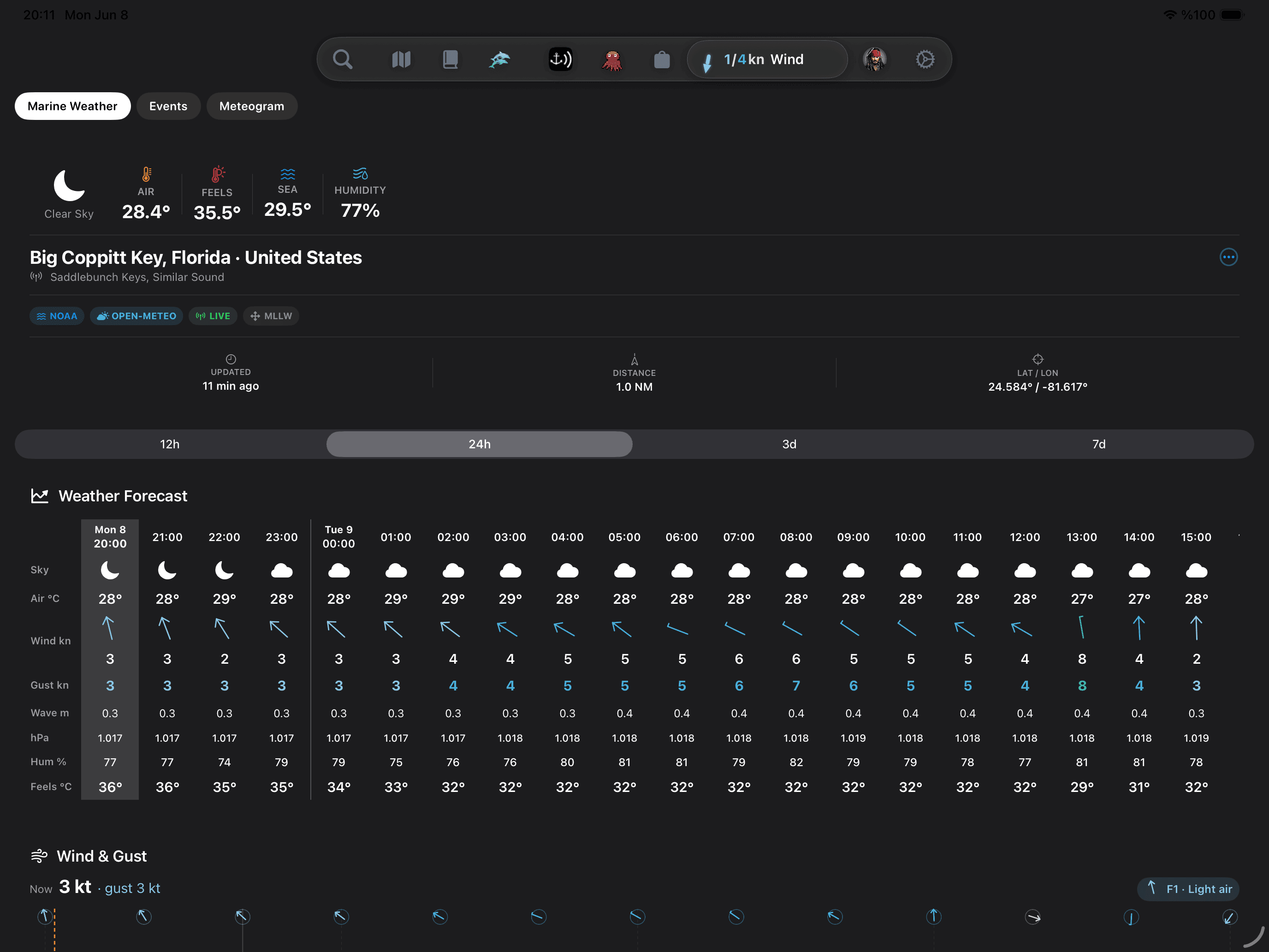
Real charts with real depths. A 3D fly-by of the marina before you ever see it. Live wind, gust, pressure and wave at the berth. Arrival, berthing and sunset times for the day you actually get there — then route straight in.
- REAL APP VIEWPort de Moure Rouge & Vieux Port, Cannes
- BERTH TELEMETRYLive wind, gust, wave, depth soundings & sunset
- FESTIVAL DISCOUNTPro $29.99/yr & Max $49.99/yr (Save up to 50%)
Official Cannes Reel
Watch the 3D marina fly-by sequence and approach into Port de Moure Rouge and Vieux Port before dropping anchor.
3D Fly-By of the Marina
See the seabed contours, shallows, and safe water paths with survey-grade bathymetry rendered directly on your iPad and iPhone.
Festival Season Discounts
Cannes Yachting Festival pricing is active live across all major tiers on Apple App Store:
Apple App Store In-App Purchase · Cancel Anytime
Up to 50% OFF
Automatic discount at checkout on Apple App Store. Start with a 1-month free trial on Pro.
Plan it. Sail it. Fly it again.
One calm platform for the whole passage — from depth-aware route planning to live guidance, automatic passage records and cinematic 3D replay.
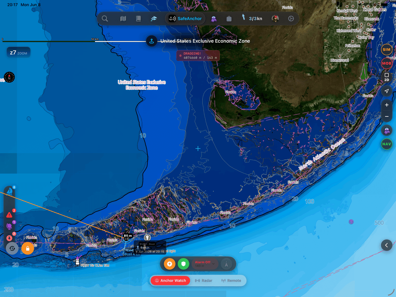
Two modes. No clutter.
Use Route while planning. Switch to Passage when underway or looking back. The chart stays familiar; the tools change with the job.
A real route · Marseille to Barcelona
One request. A passage you can inspect mile by mile.
This roughly 190 NM example shows the complete AnchorQueen workflow: ask in plain language, challenge the plan against conditions, then replay the voyage in 3D.
- 190.4 NM on the route card
- 6 waypoints
- SHALLOW relaxation shown clearly
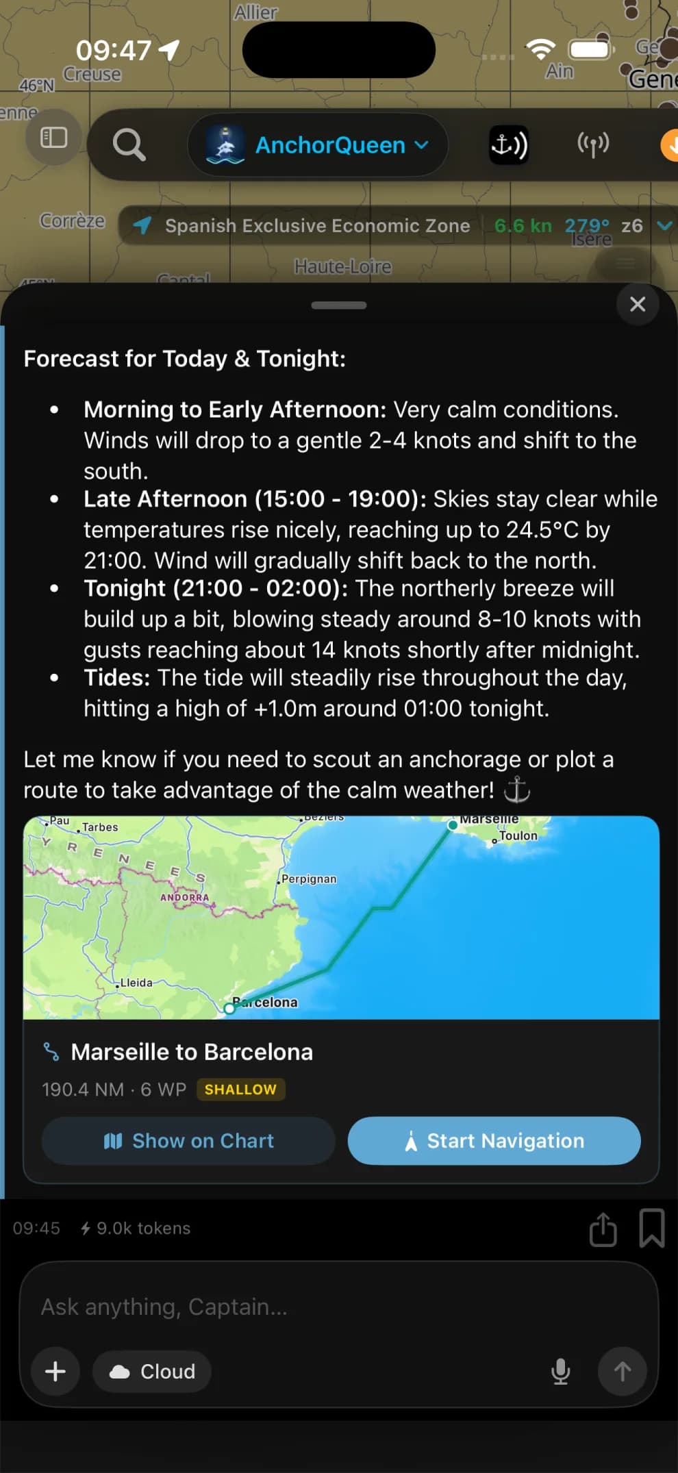
Ask Jules
Ask for Marseille to Barcelona marina in plain language. Jules returns a six-waypoint route card with direct actions to open it on the chart or start navigation.
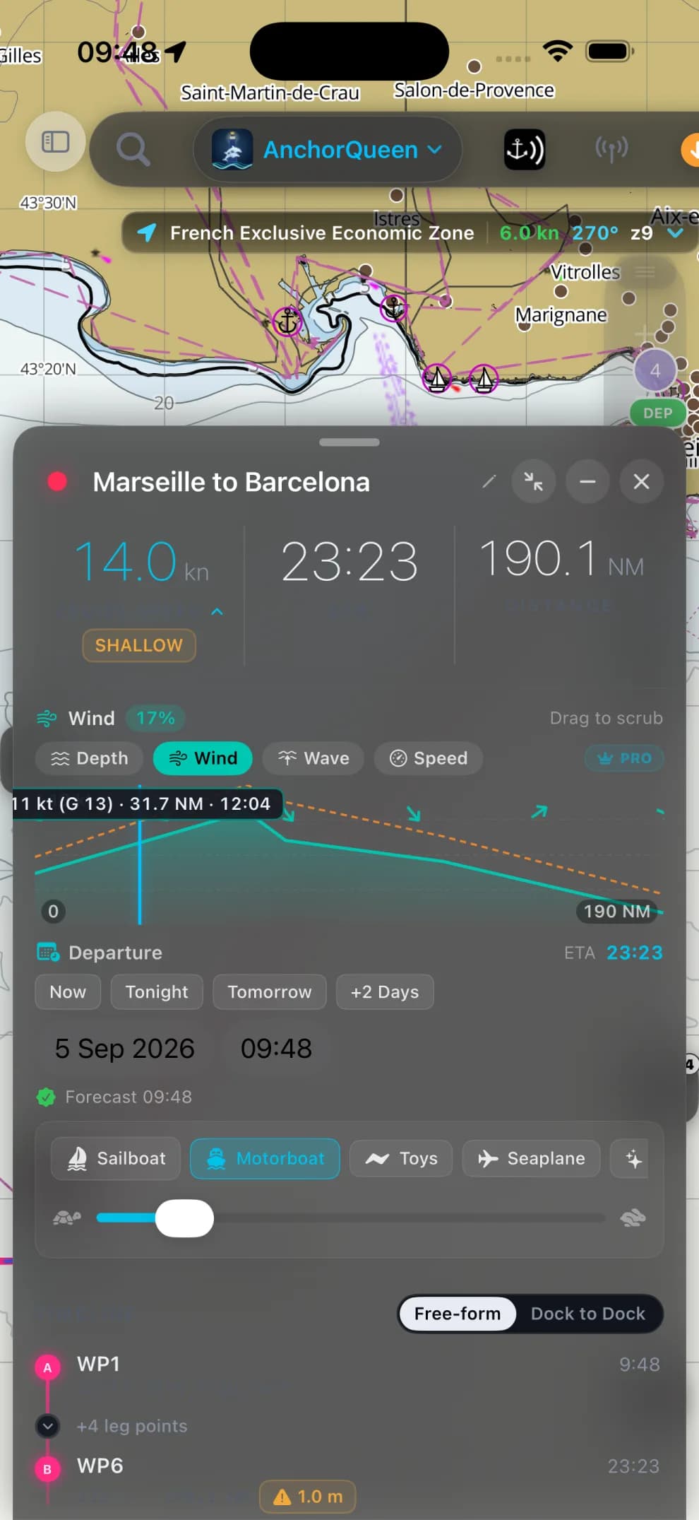
Interrogate the route
Set departure and cruise speed, then scrub wind, waves and depth across the full passage. The planner keeps its SHALLOW relaxation visible instead of hiding the compromise.
Fly it again
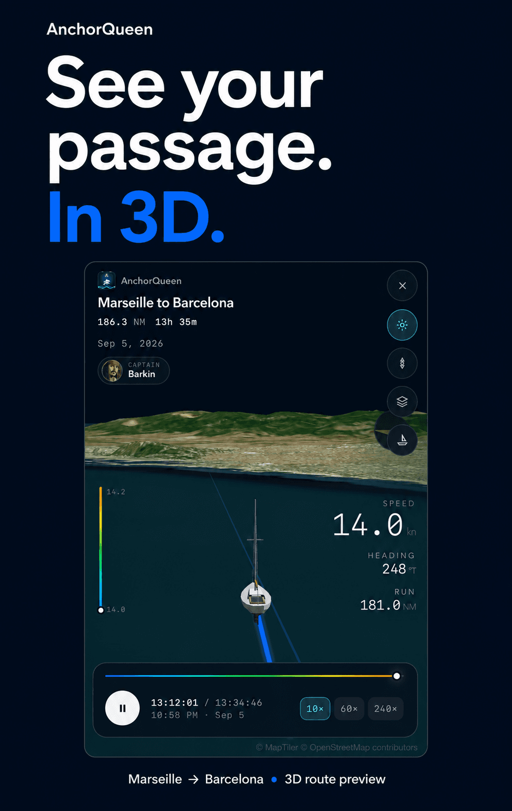
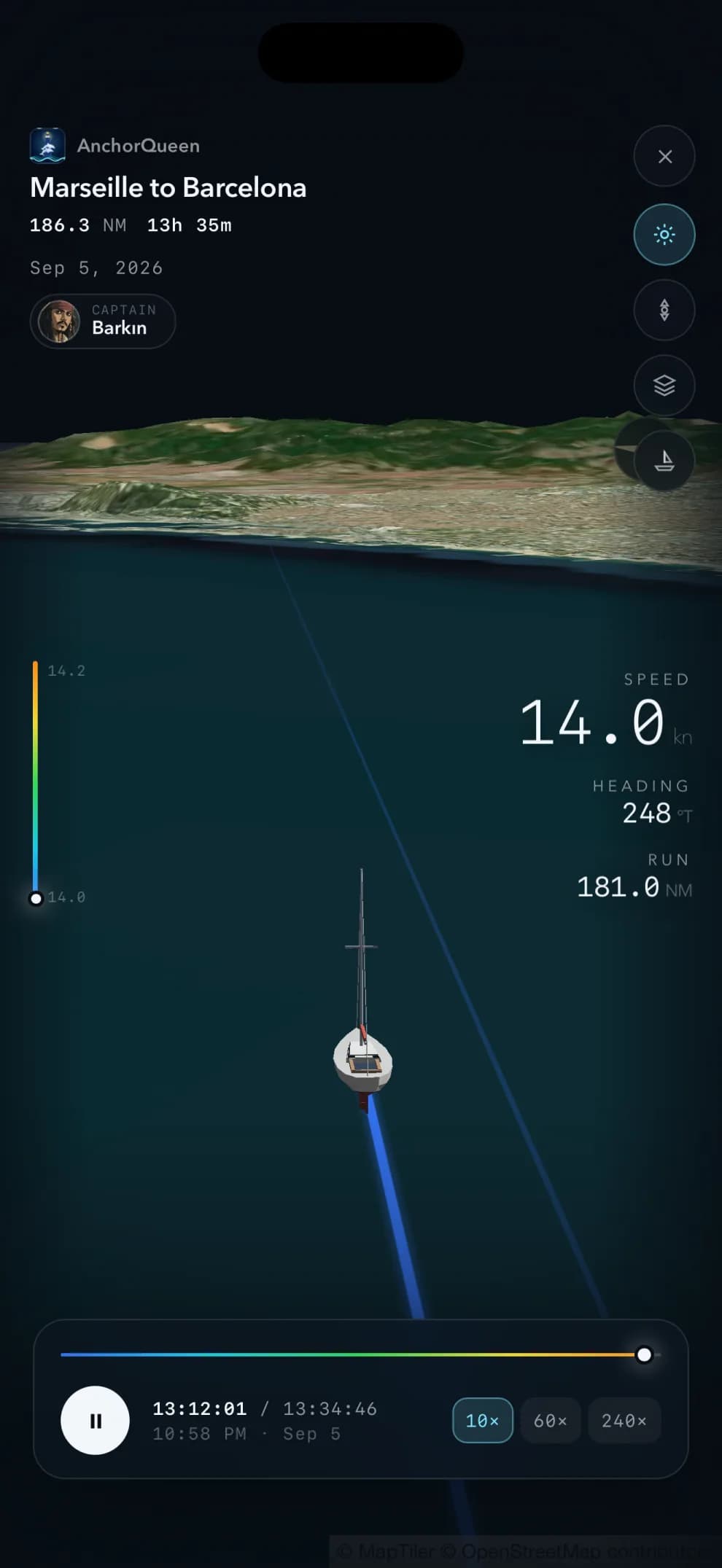
The passage becomes a 3D fly-by with your vessel, speed, heading and distance run. Scrub the day or play it back at 10×, 60× or 240×.
See the water you crossed, not just the line.
3D Fly By replays your passage over live terrain with your own vessel model and crew identity. Orbit the boat, scrub time or take the camera free.
Your co-captain is ready when you are.
Plan depth-safe passages, track every voyage, and sleep while Jules keeps watch — from one iOS app.
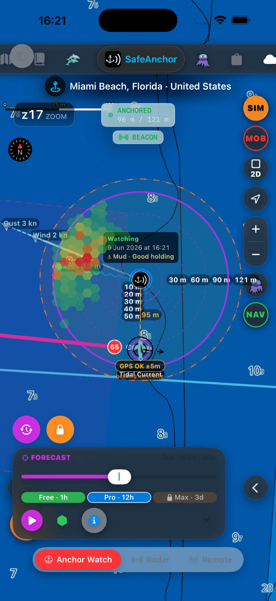
Drop the hook. Jules takes the deck.
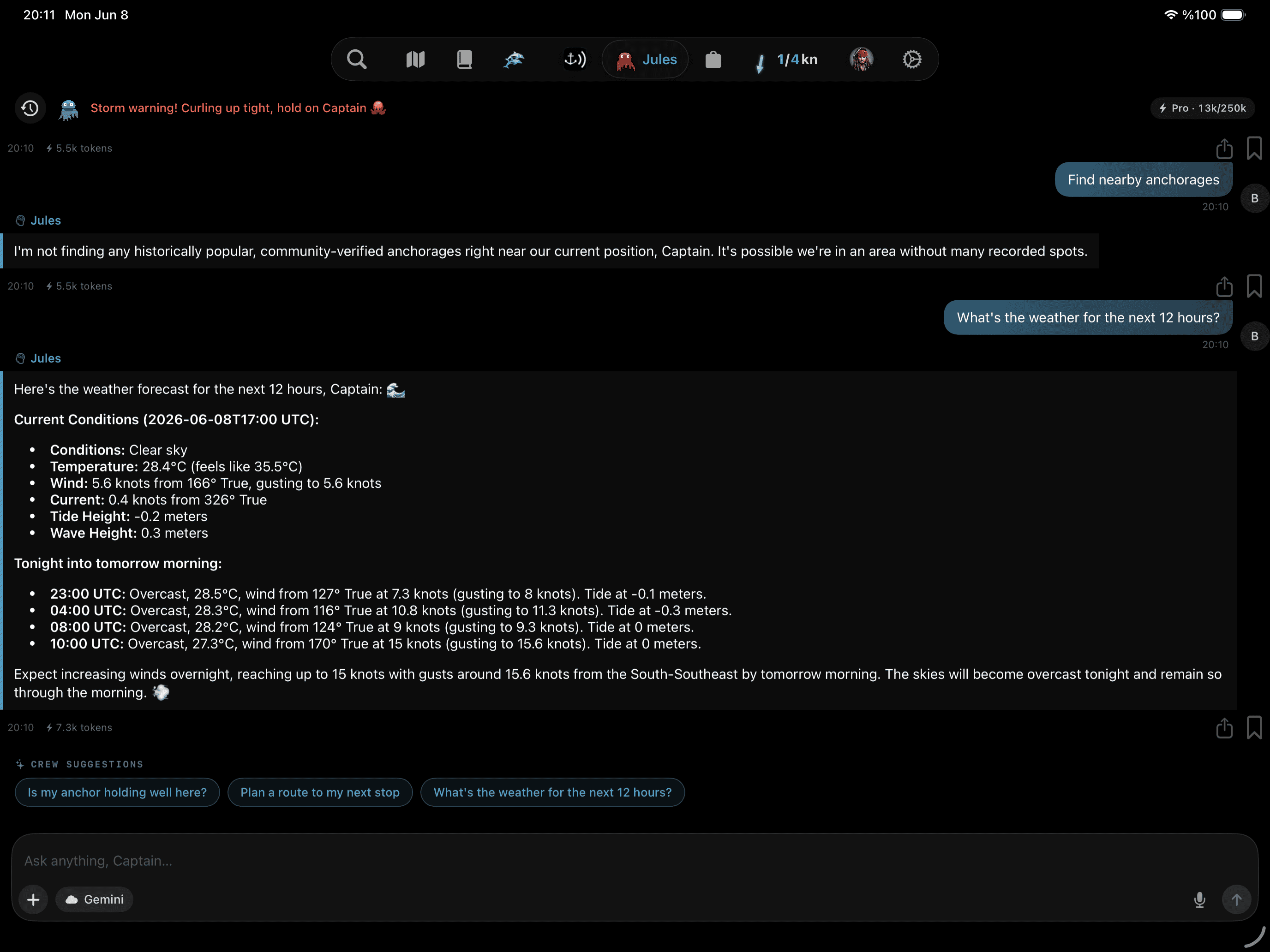
Ask anything, Captain.
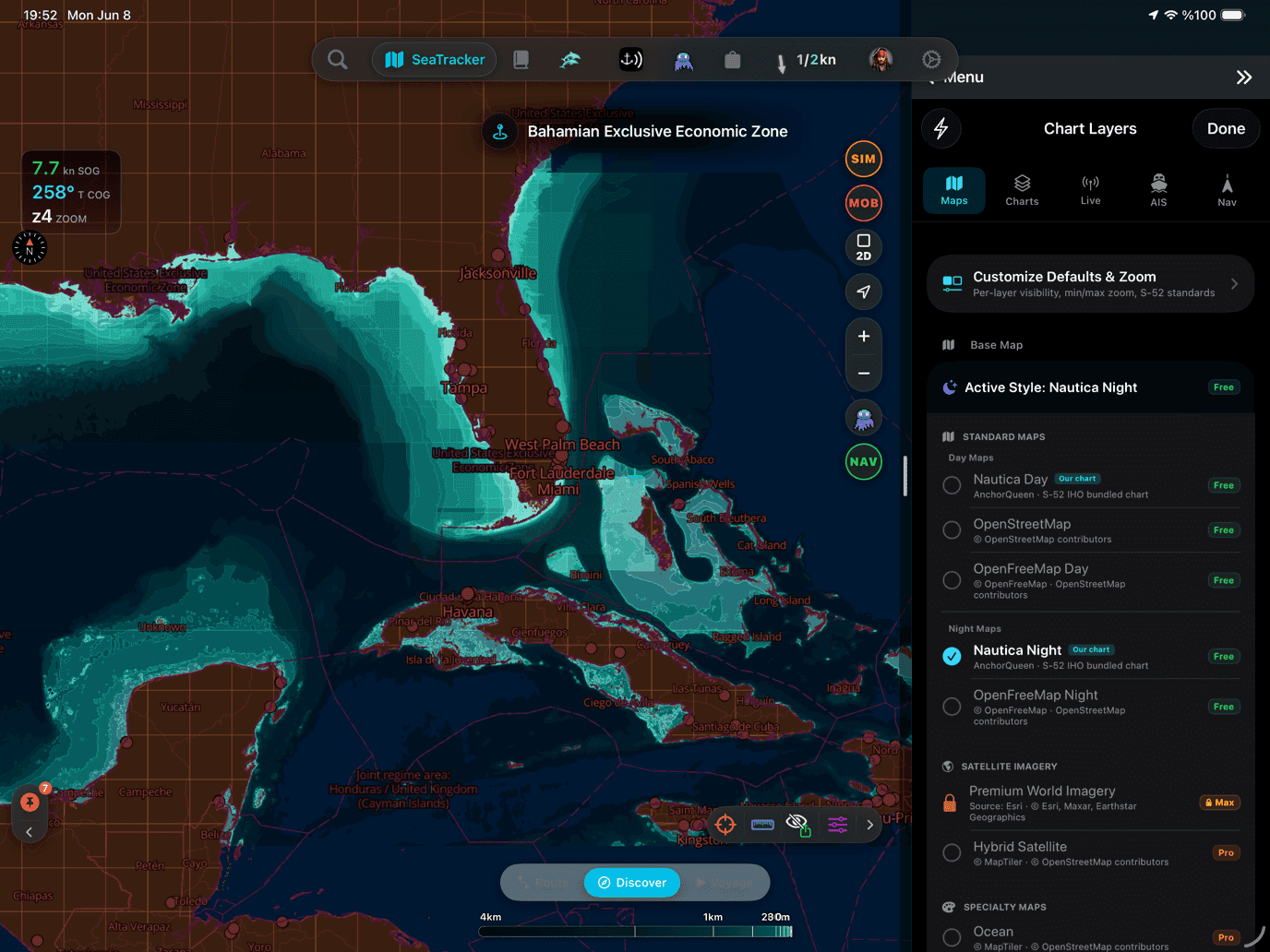
S-52 charts that adapt to the light, and the depth.
The whole sky, scored for your anchorage.
Beyond the chart
AnchorQueen isn't only navigation — keep an eye on the boat from shore, sail as a fleet, and read the sea around you.
Remote monitoring
Watch your anchored boat from your phone ashore — live position, wind, depth and battery. The map stays on the boat, not your phone.
Flotilla & live beacon
Share your position and sail as a group — private flotilla channels for up to 100 vessels, plus a free local live beacon.
Marine exploration
Layer biodiversity hotspots, commercial fishing activity and ocean currents over the chart — plan the passage and the adventure.
US coasts, the Med basins, Caribbean, Baltic and more — charts work without signal.
Backing Jules's briefings and the anchor-watch comfort score.
Weather, tides, soundings, routing, nearby vessels — reading your live state.
Hybrid A*-APF on a memory-mapped cost grid. Longer passages stay under ten.
One platform from first waypoint to last memory.
AnchorQueen 2.4.3 brings planning, guidance, recording and replay into a simpler chart experience built around what you are doing now.

Try Pro free for 1 month — cancel anytime.
Trusted by 10,000+ active captains