
 Anchor Alarm
Charts for coastal cruising
Read the water. Route around the depth.
Official S-52 chart detail, depth-aware routing, seabed and tides for the waters you cruise. Download a region once and keep navigating without signal — from $14.99/year.
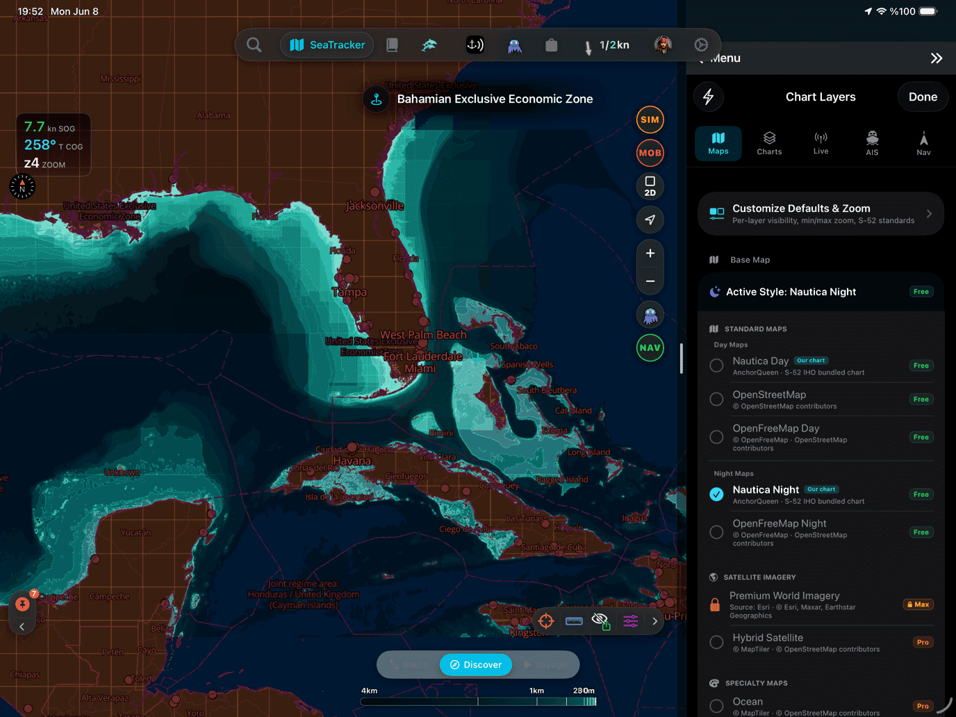
One complete cruising region
Day, night, routing, tides and seabed — downloaded together.
- chart regions
- 16
- layers per pack
- 09
- signal required
- 0
A real route · Marseille to Barcelona
One request. A passage you can inspect mile by mile.
This roughly 190 NM example shows the complete AnchorQueen workflow: ask in plain language, challenge the plan against conditions, then replay the voyage in 3D.
- 190.4 NM on the route card
- 6 waypoints
- SHALLOW relaxation shown clearly
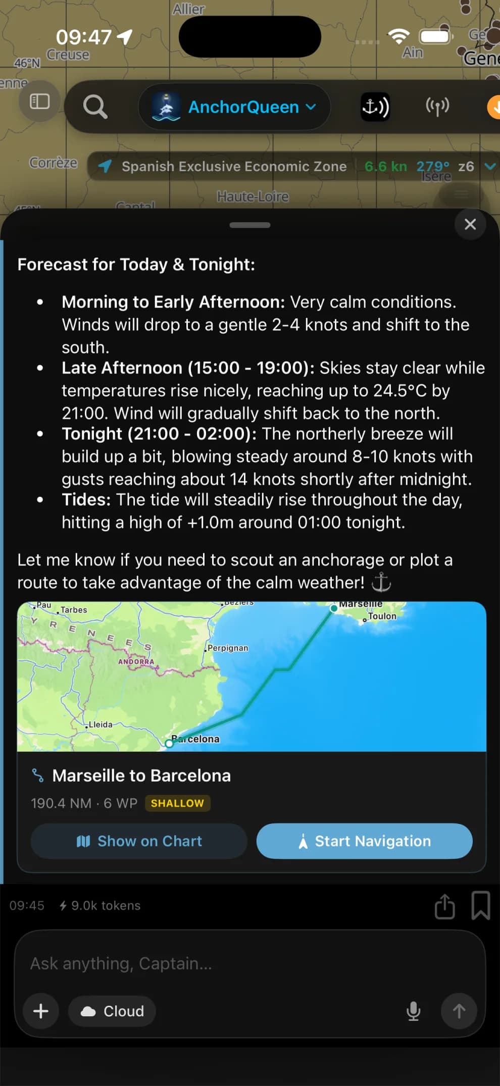
Ask Jules
Ask for Marseille to Barcelona marina in plain language. Jules returns a six-waypoint route card with direct actions to open it on the chart or start navigation.
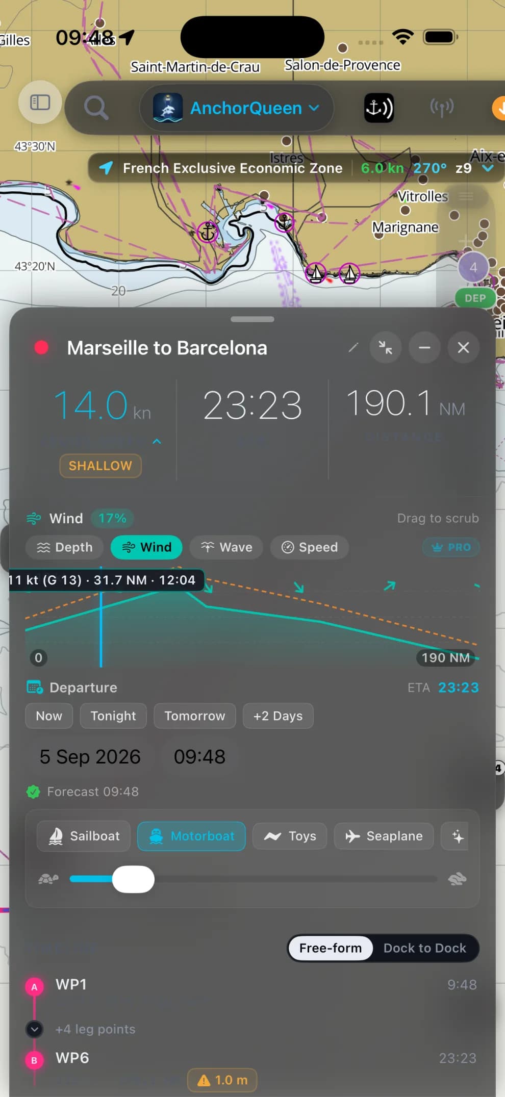
Interrogate the route
Set departure and cruise speed, then scrub wind, waves and depth across the full passage. The planner keeps its SHALLOW relaxation visible instead of hiding the compromise.
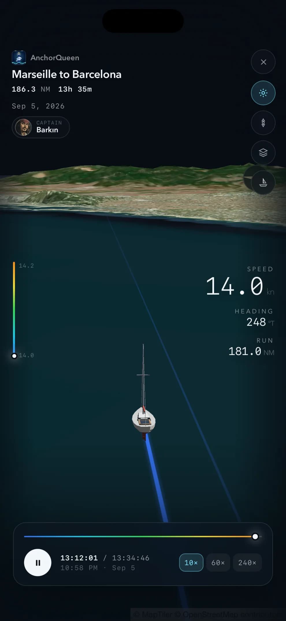
Fly it again
The passage becomes a 3D fly-by with your vessel, speed, heading and distance run. Scrub the day or play it back at 10×, 60× or 240×.
Living seamarks · Cockpit intelligence
Every mark on the chart has a story — and real-time intelligence.
Legacy chartplotters display dead abbreviations: Fl(2) 10s 9M, ⚓, Ch 77. In AnchorQueen, every seamark is an active operational briefing. Inspect real-time under-keel clearance at low water, verified seabed holding, true-cadence flash sectors, and VHF docking procedures before you commit your line.
- Vathý Bay · +6.0 m UKC at LW
- Kos Marina · 4.5 m channel · VHF Ch 77
- Cape Kéfalas Lt · Fl(2) 10s · 9 NM range
Vathý Bay
Anchorage · Kálymnos, Greece
Route here lands 17:40, two hours before sunset. Tonight's NW 18 kn stays behind the north wall.
Dynamic Anchorage Intel
Know before you drop. Real-time tide calculations compute your exact under-keel clearance at low water, while terrain ray-casting computes wind shelter across 16 compass sectors as forecast winds shift.
Approach & Berthing Protocols
Never arrive blind. See fairway depths vs your keel draft, entrance lateral buoys, assigned visitor pontoons, and exact VHF hailing waypoints before you round the breakwater.
Landfall Light & Hazard Sectors
Recognize the loom instantly. True-cadence flash sequences match what your eyes see from the cockpit, with red hazard sectors highlighted to keep you safely clear of submerged reefs.
Find your waters.
Get AnchorQueen free on iOS, then add the regions you cruise.
Popular cruising regions
 Popular
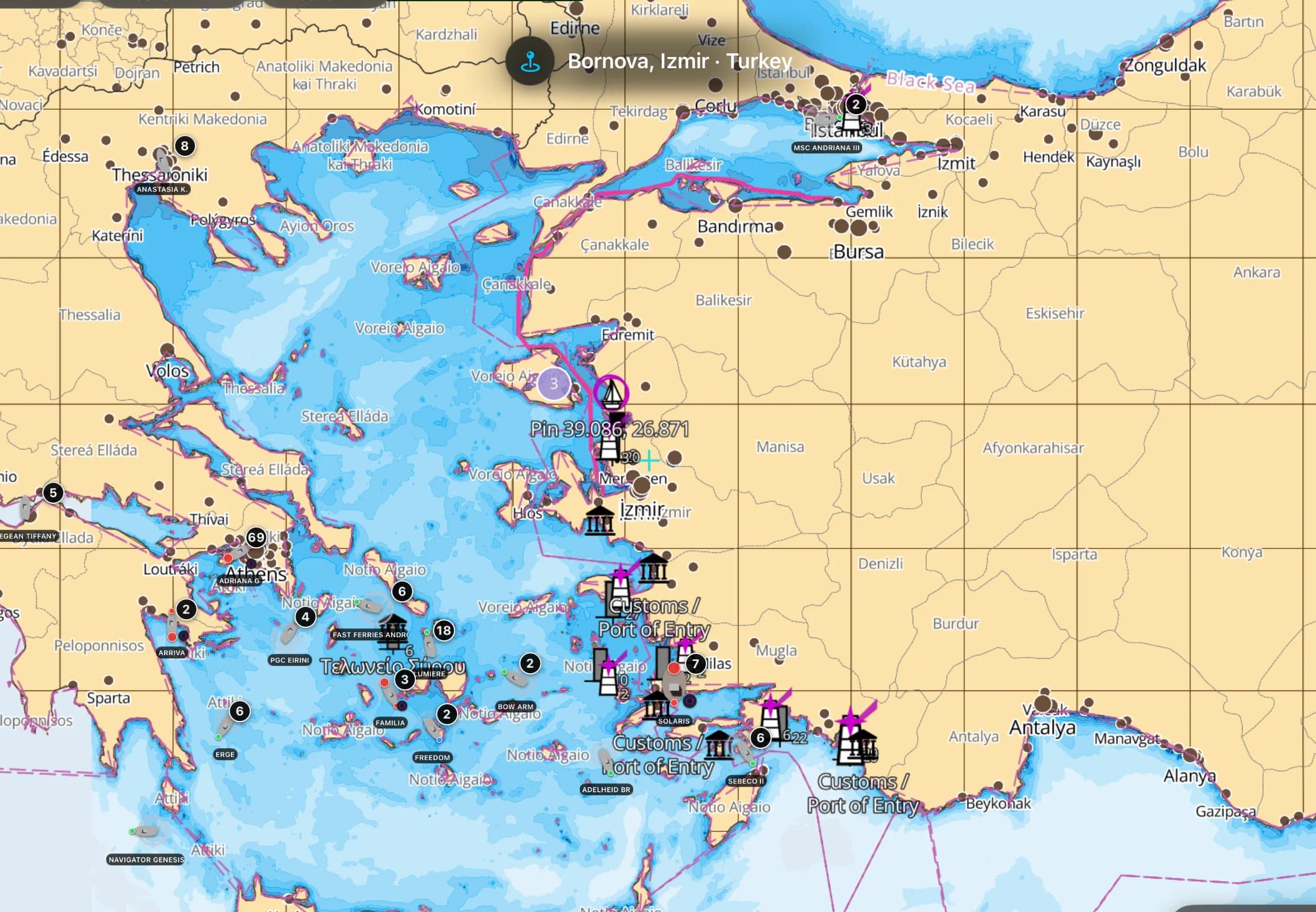
Aegean & East Mediterranean
From the Cyclades to the Turkish coast — every island, charted and offline.
 Popular
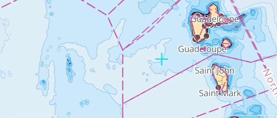
Caribbean Sea
Bahamas to the Grenadines — reef-strewn water that demands a real chart.
 Popular
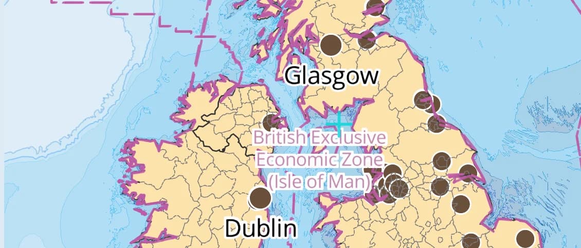
British Isles & Channel
The Solent to the Hebrides — big tides, busy water, charted to the buoy.
 Popular
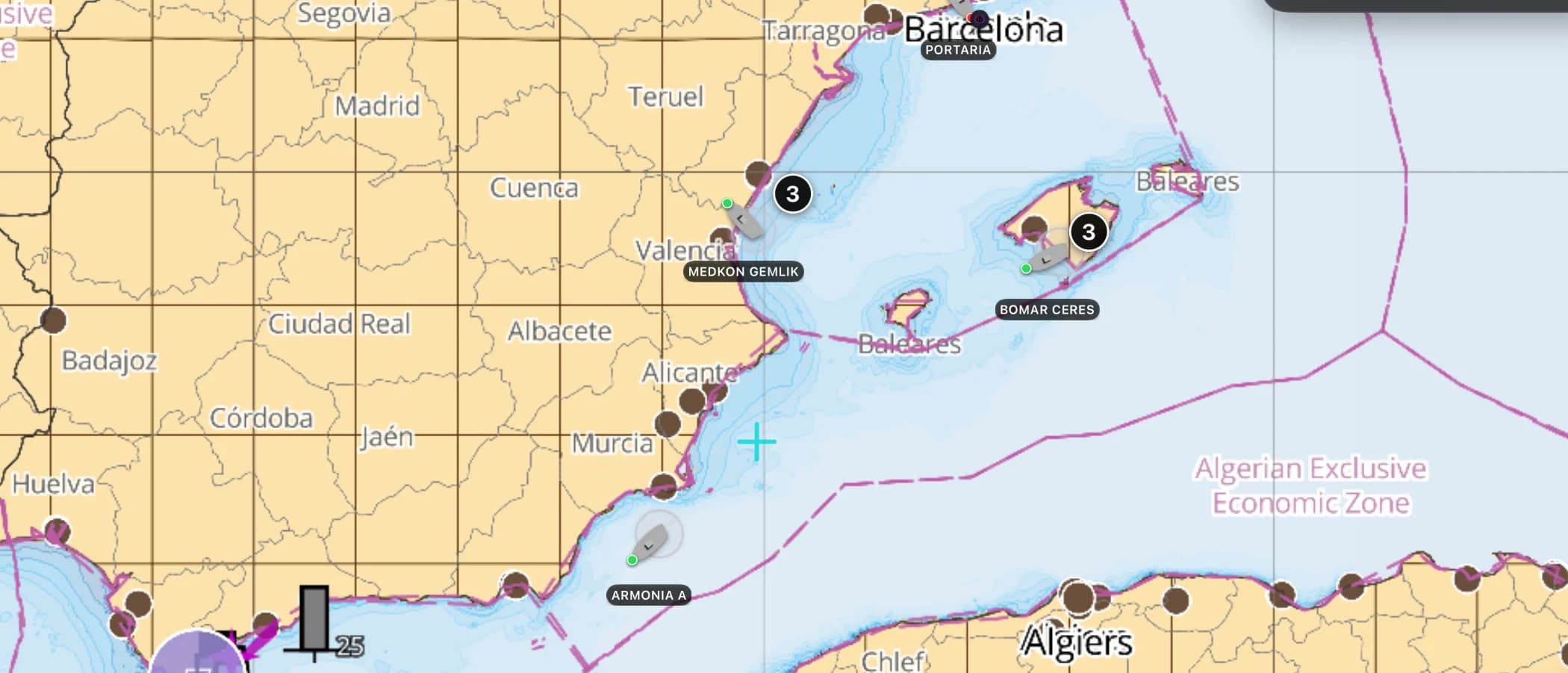
Western Mediterranean
Balearics to the Côte d'Azur — the Med's classic cruising triangle.
Baltic Sea
The Swedish and Finnish archipelagos — thousands of rocks, charted.
Norway South-West
Oslofjord to Bergen — the gateway to the fjords.
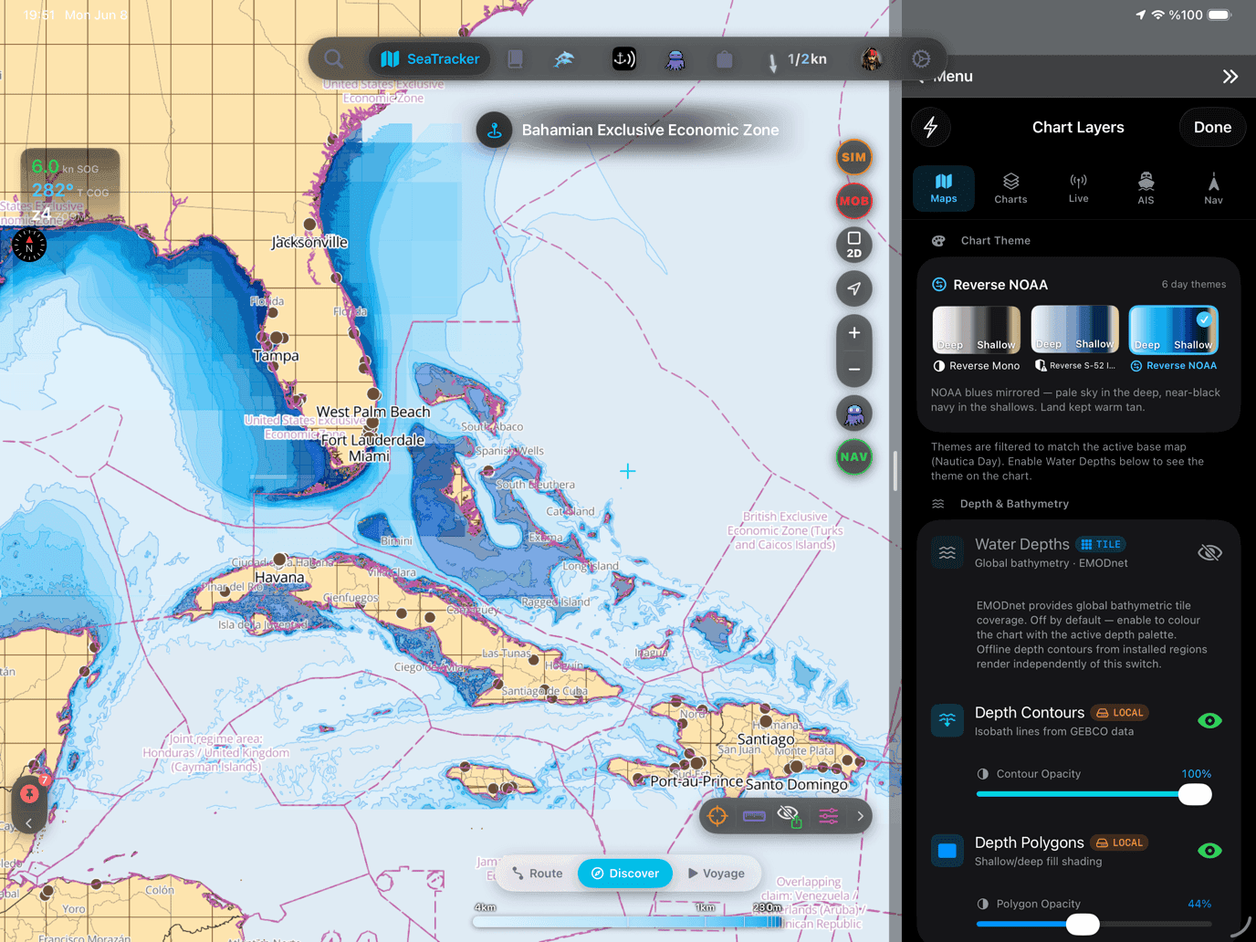
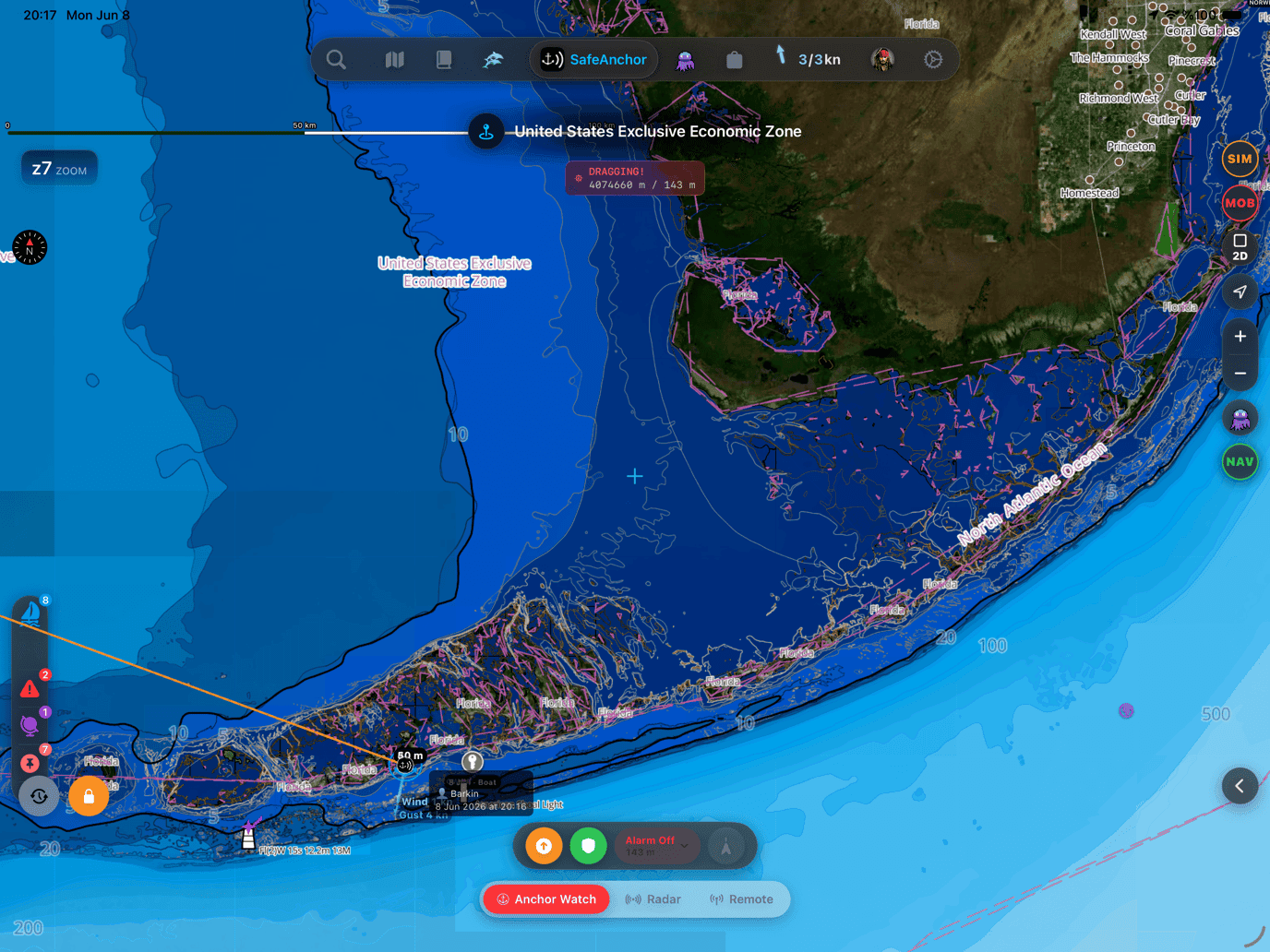
Charts styled for any light
Nautica Day & Night S-52, depth palettes and hybrid satellite — switch offline, anytime.
In every region pack
Nine layers our chart pipeline bakes for every region — seabed and holding included.
Nautica Day & Night charts
S-52 vector cartography styled for daylight and night watches.
Depth-aware routing
Route planning that respects your draft and the charted depths.
Seabed & holding
Charted seabed type and holding quality from S-57 substrate — know what you’re anchoring into.
Soundings & depth contours
Spot depths and contours across the whole region.
Tides & currents
Tidal heights and streams, bundled in.
Rocks, wrecks & hazards
Charted obstructions so you can plan a clean approach.
Harbours & anchorages
Marinas, harbours and anchorages along the coast.
Lights, buoys & beacons
Charted navaids with their light characteristics.
Fully offline
Download once over wifi; navigate with no signal.
Chart ownership
Clear before you buy. Clear after access ends.
Charts are safety equipment. The ownership contract should be as readable as the depths.
Buy one region
A separate $14.99/year chart subscription. Works on Free, Pro or Max and does not use an included plan slot.
Include three with Pro
Choose three regions while Pro is active, alongside the complete Pro experience.
Open the whole folio
Every chart region is available while Max is active — no region-by-region decisions.
The complete working chart
Read the downloaded S-52 chart offline, install current updates, and use the region's depth-aware routing, tides, seabed and hazards.
Your downloaded chart still opens
The last version already installed on this device remains readable. Renew to download updates, install it again, or use depth-aware routing in that region.
A direct region subscription covers that chosen region at any plan level. Pro and Max chart access follows the plan. App Store local pricing and renewal terms apply.
Auto-renewing, billed securely through your App Store account — no card forms, no separate logins. Cancel anytime.
Charted by the United States government.
Six of our region packs are built from the official Electronic Navigational Charts of the United States — NOAA's Office of Coast Survey for the coasts, the Great Lakes and the Caribbean approaches, the US Army Corps of Engineers for the navigable river system. Not redrawn, not a third-party interpretation: the federal survey data itself, re-cut for your phone and stored offline.
- NOAA ENC
- USACE Inland ENC
- Official S-57 source
- Public domain
The source, not a copy
NOAA and USACE publish their charts as S-57 ENC cells. Our pipeline parses those cells directly, so depth areas, soundings, wrecks, rocks, channels and aids to navigation arrive as the hydrographers surveyed them — never traced off an image.
The paper chart is gone
NOAA finished cancelling its traditional paper and raster charts in January 2025. The ENC is now the only official US chart there is, which makes reading it properly the whole job rather than a bonus feature.
Public data, honest price
US government charts are public domain and carry no licence fee. That is why a US region is $14.99 a year flat — charts, depth-aware routing, tides and seabed included — instead of a chart licence billed on top of the app.
The rivers, charted end to end
The US Inland Rivers pack is built from 109 USACE Inland ENC charts covering the Mississippi, Ohio, Tennessee and Illinois systems — locks, dams and bridge clearances included. The Great Loop, on charts made for it.
Government-charted regions
Source data: NOAA Office of Coast Survey and the US Army Corps of Engineers, in the public domain. AnchorQueen is an independent product, not affiliated with, endorsed by or certified by NOAA, USACE or any US government agency. Region packs are derived charts for situational awareness and do not replace the official charts a vessel is required to carry.
Charts you can trust
Built on official S-57 ENC, EMODnet 2022 and GEBCO bathymetry, fused with community-verified navaids, rocks and wrecks — the survey-grade vector data that’s replacing paper charts.
- Official S-57 ENC
- EMODnet 2022
- GEBCO bathymetry
- OSM SeaMarks
Find your waters.
Get AnchorQueen free on iOS, then add the regions you cruise.

On iPhone and iPad now — Android coming soon.
Manual · Charts →