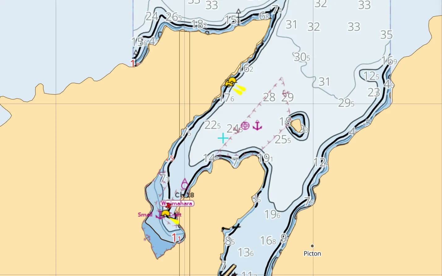
At the northern tip of New Zealand's South Island, tectonic subsidence and rising post-glacial seas drowned an entire mountain range to create the Marlborough Sounds—more than 1,500 kilometres of bush-clad coastline split across Queen Charlotte Sound (Tōtaranui), Pelorus Sound (Te Hoiere) and Kenepuru Sound. Sheltered from the open swells of Cook Strait by steep 700-metre ridges and Arapaoa Island, the Sounds offer flat-water reach sailing between beech-forested coves, historic Captain Cook anchorages at Ship Cove, and waterfront lodges reachable only by boat or the Queen Charlotte Track.
Just west across Tasman Bay lies the golden granite coast of Abel Tasman National Park. This guide covers the charter bases at Waikawa and Picton, a 7-day Queen Charlotte Sound itinerary, how to handle deep-fjord anchoring and club moorings, and the serious tidal gates of Tory Channel and French Pass (Te Aumiti).
Quick facts & season
Marlborough consistently records some of New Zealand's highest sunshine hours. The primary charter and cruising season runs from November through April, with settled autumn days in March and April offering lighter valley gusts and quieter moorings.
| Cruising overview | Marlborough Sounds & Abel Tasman (South Island, NZ) |
|---|---|
| Peak cruising season | November to April (summer & autumn); sheltered inner-sound cruising year-round |
| Wind character | Funnelled NW or SE winds along the sound axes; watch for strong katabatic squalls off the ridges |
| Tidal streams | Moderate inside Queen Charlotte Sound; fierce at Tory Channel (up to 7 kt) and French Pass (5–8 kt) |
| Main marinas & bases | Waikawa Marina (600 berths), Picton Marina, Havelock Marina (Pelorus Sound), Nelson Marina (Abel Tasman) |
| Official chart source | LINZ Hydrographic ENC (New Zealand South offline pack) |
| Charter listings | Compare South Island & NZ boats on New Zealand yacht charter |
Waikawa, Picton & Havelock: South Island Charter Hubs
A 7-day itinerary: Queen Charlotte Sound (Tōtaranui)
This ~68 nm loop stays entirely inside the sheltered waters of Queen Charlotte Sound, making it suitable for bareboat charter agreements that prohibit exiting into Cook Strait.
Clear the Waikawa channel, keep well out of the Picton ferry lane, and sail across to Double Cove (a no-take marine reserve where tame blue cod swim under the transom) or Kumutoto Bay on the northern shore.
Sail down the main reach past Allports Island into Bay of Many Coves. Deep coves at the western head (Craggy Cove and Arthur's Bay) provide calm overnight shelter and access to waterfront dining.
Cross the sound and enter Endeavour Inlet, the longest northern arm of Queen Charlotte Sound. Pick up a visitor mooring or anchor off Punga Cove or historic Furneaux Lodge, and walk a coastal section of the Queen Charlotte Track.
Sail toward the outer sound to Ship Cove (Meretoto), where Captain James Cook careened HMS Resolution five times between 1770 and 1777. Take the dinghy across to Motuara Island (a predator-free DOC bird sanctuary) to climb the lookout tower over Cook Strait and hear saddlebacks (tīeke) and bellbirds.
Tuck back south of Cooper Point into Resolution Bay or Ruakaka Bay, watching out for marine mussel farms tucked along the shoreline.
Sail down the eastern side of the sound past Blumine Island (another pest-free conservation island with historic WWII gun emplacements) and anchor in Oyster Bay or Erie Bay on Arapaoa Island, well clear of the main Tory Channel ferry stream.
Pause at Lochmara Bay for a lunchtime ashore walk before beating or reaching back up the sound to the fuel jetty at Waikawa.
Creating the Route with Jules AI & Waypoint-by-Waypoint Breakdown
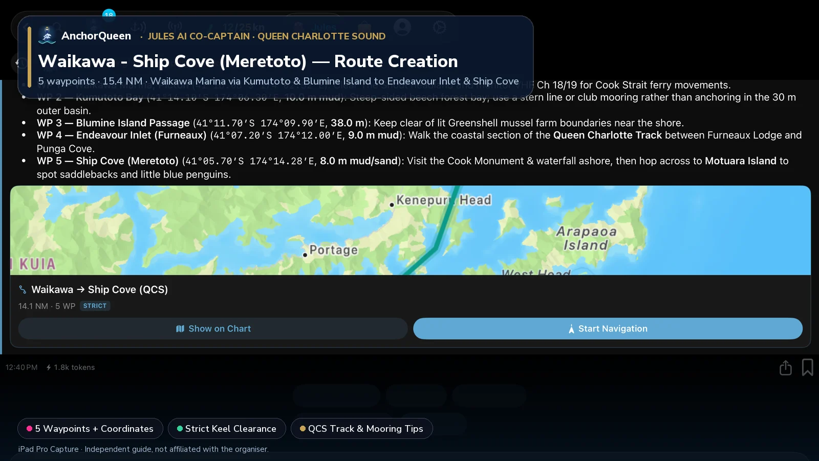
To plan a passage down the drowned river valleys of Queen Charlotte Sound (Tōtaranui) from Waikawa Marina to Endeavour Inlet and Captain Cook's historic anchorage at Ship Cove (Meretoto), ask Jules AI in AnchorQueen:
Prompt to Jules AI: "Jules, plan a Queen Charlotte Sound route from Waikawa Marina to Endeavour Inlet and Ship Cove (Meretoto) at 6 kn. Show the waypoints, mooring tips, and Queen Charlotte Track stops."
Planned Waypoints, Coordinates & Things to Do
| WP # | Waypoint & Coordinates | Course & Leg | Depth & Holding | Things to Do Ashore & On the Water |
|---|---|---|---|---|
| WP 1 | Waikawa Marina, Picton41°16.08′S 174°02.52′E | Departure berth | 4.5 m marina | Provision in Picton, check your bareboat club mooring pass, and clear The Snout headland while monitoring VHF Ch 18/19 for Cook Strait ferries. |
| WP 2 | Kumutoto Bay41°14.10′S 174°06.30′E | 055°T · 3.5 NM | 10.0 m mud | Pick up a club mooring or anchor at the head of this beech-forested cove; swim with blue cod in nearby Double Cove Marine Reserve (no fishing). |
| WP 3 | Blumine Island Passage41°11.70′S 174°09.90′E | 048°T · 3.6 NM | 38.0 m fjord | Pass west of Blumine Island (Oruawairua) conservation reserve; land by dinghy to inspect the historic WWII gun emplacements and listen for orange-fronted parakeets (kākāriki). |
| WP 4 | Endeavour Inlet (Furneaux)41°07.20′S 174°12.00′E | 019°T · 4.8 NM | 9.0 m mud | Moor off Furneaux Lodge or Punga Cove; hike the coastal tree-fern section of the Queen Charlotte Track and dine ashore at the waterfront homestead. |
| WP 5 | Ship Cove (Meretoto)41°05.70′S 174°14.28′E | 049°T · 2.3 NM | 8.0 m mud/sand | Visit the Captain Cook Monument and waterfall ashore, then tender across the channel to Motuara Island bird sanctuary to climb the Cook Strait lookout tower. |
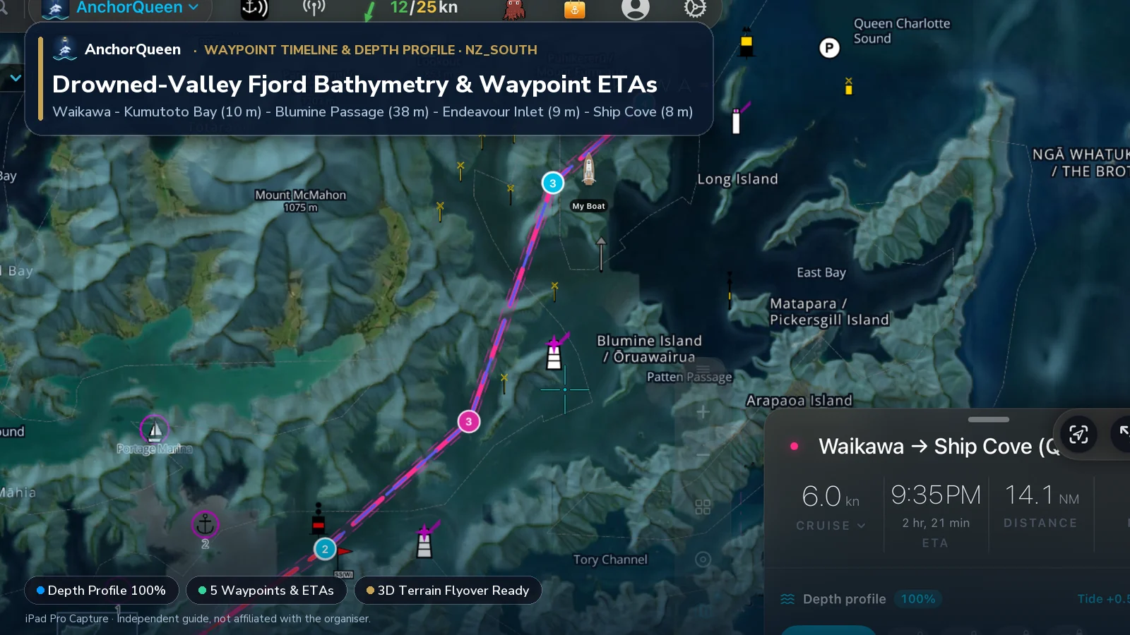
Switching Chart Types: Hybrid Satellite vs. Official LINZ S-52 Chart
In steep-sided fjords where the bottom drops from 8 metres to 35 metres in two boat-lengths, switching chart layers is invaluable:
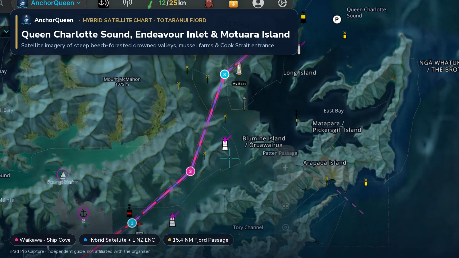
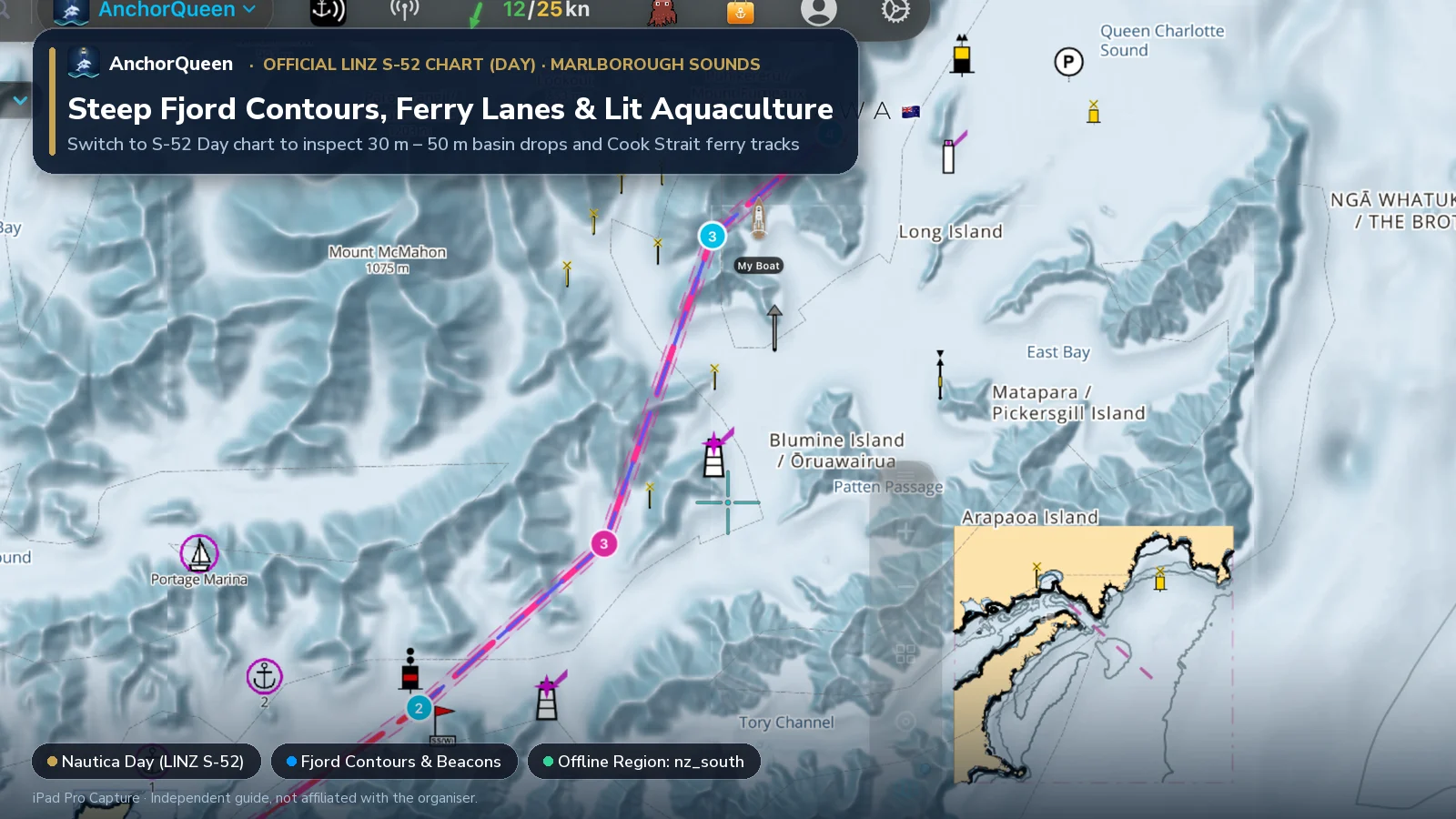
3D Route & Terrain Flyover
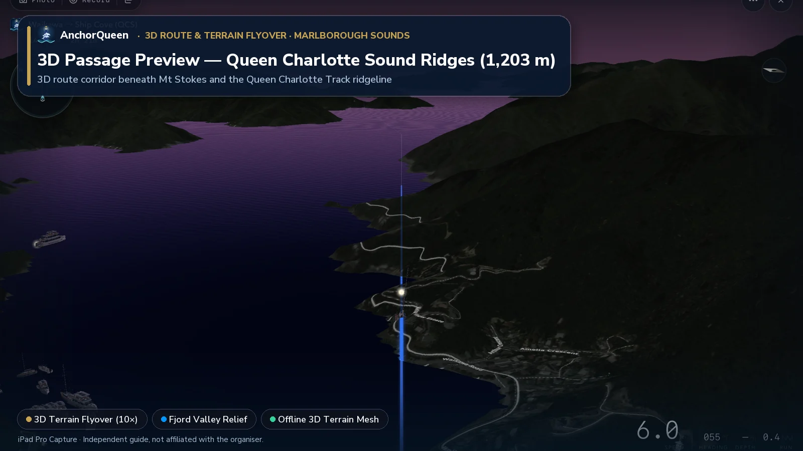
Tap 3D Terrain Flyover on the Route HUD to fly between the 700 m–1,200 m mountain ridges of the Marlborough Sounds from Waikawa Marina all the way out to Ship Cove and Motuara Island:
Seamanship in the Sounds: Steep Depths, Ferries & Tidal Gates
1. Anchoring in drowned valleys & club moorings
Because the Marlborough Sounds are flooded mountain valleys, the seabed drops rapidly: it is common to read 8 metres one boat-length off the beach and 30 metres two boat-lengths astern.
2. Interislander & Bluebridge ferry wake awareness
Large roll-on/roll-off Cook Strait ferries transit between Picton Harbour, the central Queen Charlotte Sound reach and Tory Channel. Even under the 15–18 knot speed management bylaws inside the Sound, large ferries displace significant water. Stay well outside the main shipping track around Dieffenbach Point and never anchor near the narrow Tory Channel entrance.
3. Tory Channel & French Pass (Te Aumiti) tidal gates
If you are delivering a yacht between Queen Charlotte Sound, Pelorus Sound and Abel Tasman / Nelson:
Offline LINZ charts & SafeAnchor in the Sounds
Cellular coverage in the Marlborough Sounds and Abel Tasman is patchy behind the 700-metre ridges, and mussel farms line many secondary bays.
Download AnchorQueen free on the App Store · Android: join the Poseidon Android beta · Browse New Zealand yacht charters
Safety note
This guide is for planning only. Distances and depths are approximate, bareboat charter companies enforce strict geographic limits (often prohibiting Tory Channel and French Pass), and Cook Strait / French Pass currents are hazardous outside slack water. Always consult current official LINZ charts, tidal stream tables, Marlborough District Council Harbourmaster bylaws and MetService forecasts before sailing.