Sheltered behind the outer barrier of the Great Barrier Reef at latitude 20°S, the 74 islands of the Whitsundays form Australia's largest bareboat charter ground. Fringing coral gardens, deep fjord-like inlets on Hook Island, and the seven-kilometre silica sandbar of Whitehaven Beach sit within a compact twenty-five-mile cruising box out of Airlie Beach and Hamilton Island.
Unlike southern Australia (Sydney and Tasmania) or New Zealand—which peak from December to March—tropical North Queensland runs on an inverse trade-wind calendar. If you are reading this during the southern summer, now is the moment to plan and book a Whitsundays autumn/winter escape (April to October)—or, if you sail during the tropical summer shoulder, to understand the cyclone, stinger and reef-zoning rules that govern the islands.
Seasonality truth: When to sail the Whitsundays
Getting the season right is the single most important decision for a Queensland charter:
| Season window | Months | Conditions & what to expect |
|---|---|---|
| Peak Dry Season (Trade-Wind Winter & Spring) | April to October | Prime charter window. Warm, dry days (23–28°C), low humidity, steady south-easterly trade winds (15–22 kt), minimal rain, and outside the peak tropical cyclone season. August hosts Airlie Beach Race Week and Hamilton Island Race Week. |
| Tropical Wet / Cyclone / Stinger Season | November to March | Hot, humid weather (30°C+) with lighter, variable northerly breezes, tropical downpours, official Australian tropical cyclone season (1 Nov – 30 Apr), and peak marine stinger (box jellyfish & Irukandji) activity requiring full-body stinger suits whenever swimming. |
If you are booking ahead from Sydney, Melbourne, Auckland or Europe for a southern winter escape between April and October 2027, compare boats early on our Queensland and Airlie Beach charter pages.
Charter bases: Coral Sea Marina (Airlie Beach) & Hamilton Island
A 7-day Whitsundays route from Coral Sea Marina
This classic ~90 nm loop stays inside the 10 o'clock–to–4 o'clock inner-island cruising limits of Airlie Beach bareboat operators, combining the deep inlets of Hook Island with Whitehaven Beach and the fringing reefs of the northern group.
After your morning area briefing and radio check across Pioneer Bay and the Whitsunday Passage, sail northeast into Nara Inlet, a long, steep-sided fjord carving into the south coast of Hook Island. Anchor in good mud holding and take the dinghy ashore at the head of the inlet to view the Ngaro cultural cave rock art.
Sail down Hook Passage into Tongue Bay on the north side of Whitsunday Island and pick up a public mooring (arrive before 10:00 for a buoy). Walk the bush track up to the Hill Inlet Lookout over the swirling turquoise sandbars at the northern end of Whitehaven Beach, then continue around Craig Point to Chance Bay or the southern end of Whitehaven Beach for the night (in settled SE trades).
Sail north along the eastern shore of Hook Island past Border Island and Hook Reef (keeping well outside the reef edge) to the fringing coral bays on Hook Island's northern tip: Butterfly Bay, Maureen's Cove and Luncheon Bay. Pick up a blue public reef-protection mooring to snorkel over staghorn and plate coral.
Make a morning snorkel stop on a day buoy at Blue Pearl Bay (western side of Hayman Island) or Langford Island Spit, then drop down to Stonehaven Anchorage (protected from south-easterly trades behind Hook Island) to watch the sunset over Hayman Passage.
Cross the Hook Island Channel into Macona Inlet (adjacent to Nara Inlet) or Cid Harbour between Whitsunday and Cid Islands (note: swimming is strictly prohibited in Cid Harbour following shark incidents; treat Cid Harbour as an overnight anchorage and hike the Whitsunday Peak trail ashore).
Thread south through Fitzalan Passage (check tidal streams and lead marks carefully) to Hamilton Island Marina for a night on the dock, water and fuel top-up, and dinner ashore on Front Street.
Exit Hamilton Island on a morning tide, pause off Bauer Bay (South Molle Island) for lunch, and sail back across the Whitsunday Passage to Coral Sea Marina in Airlie Beach.
Creating the Route with Jules AI & Waypoint-by-Waypoint Breakdown
Before your morning charter briefing at Coral Sea Marina, ask Jules AI in AnchorQueen to build a reef-safe route across Whitsunday Passage to Hook Island, Hill Inlet, Whitehaven Beach and Hamilton Island:
Prompt to Jules AI: "Jules, plan a Whitsundays charter loop from Coral Sea Marina in Airlie Beach to Nara Inlet, Butterfly Bay, Hill Inlet / Whitehaven Beach, and Hamilton Island. Give me waypoints and GBRMPA mooring tips."
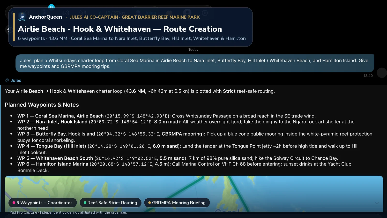
Planned Waypoints, Coordinates & Things to Do
| WP # | Waypoint & Coordinates | Course & Leg | Depth & Holding | Things to Do Ashore & On the Water |
|---|---|---|---|---|
| WP 1 | Coral Sea Marina, Airlie Beach20°15.99′S 148°42.93′E | Departure berth | 4.0 m marina | Complete your bareboat area briefing, check the 4.0 m spring tide tables, and cross Whitsunday Passage on a broad reach in the SE trade wind. |
| WP 2 | Nara Inlet, Hook Island20°09.72′S 148°54.12′E | 059°T · 12.2 NM | 8.0 m mud | All-weather overnight fjord; take the dinghy to the northern head of the inlet and walk the boardwalk to the Ngaro Aboriginal rock art cave. |
| WP 3 | Butterfly Bay, Hook Island20°04.32′S 148°55.32′E | 012°T · 5.5 NM | GBRMPA mooring | Pick up a blue cone public mooring inside the white-pyramid Reef Protection Markers; snorkel over vibrant staghorn and plate coral gardens. |
| WP 4 | Tongue Bay (Hill Inlet)20°14.28′S 149°01.20′E | 151°T · 11.4 NM | 6.0 m sand | Land the tender at the Tongue Point jetty ~2 hours before high water and walk up to Hill Inlet Lookout over the swirling turquoise silica sandbars. |
| WP 5 | Whitehaven Beach South20°16.92′S 149°02.52′E | 155°T · 2.9 NM | 5.5 m silica sand | Anchor in 98% pure silica sand outside the no-anchoring markers; swim along the 7 km beach and hike the Solway Circuit to Chance Bay. |
| WP 6 | Hamilton Island Marina20°20.88′S 148°57.12′E | 232°T · 6.4 NM | 4.5 m marina | Approach via Fitzalan Passage, call Marina Control on VHF Ch 68 before entering, top up water and fuel, and watch sunset from One Tree Hill. |
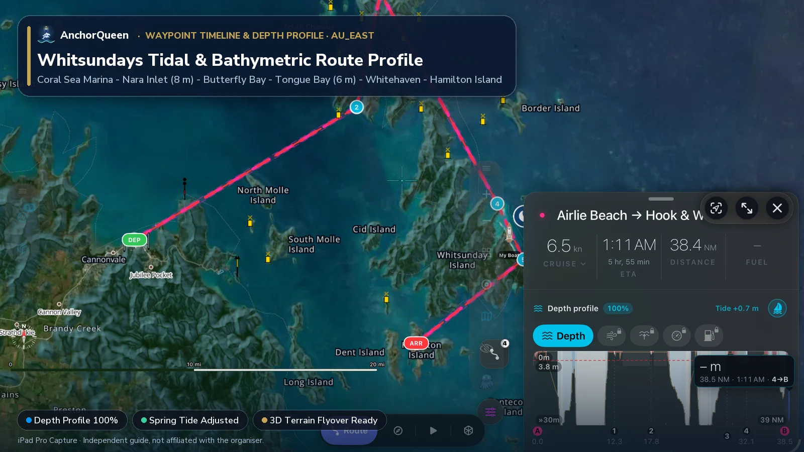
Switching Chart Types: Hybrid Satellite vs. Official S-52 Hydrographic Chart
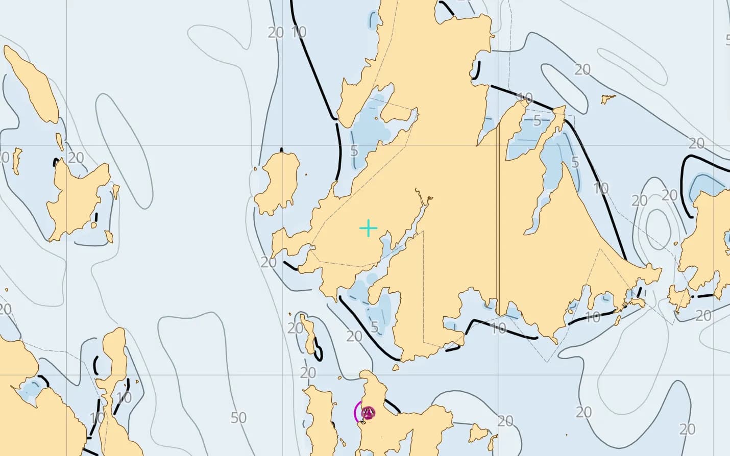
In coral-fringed waters with 4-metre tides, pairing satellite imagery with official S-52 vector charts gives you complete situational awareness:
au_east chart pack.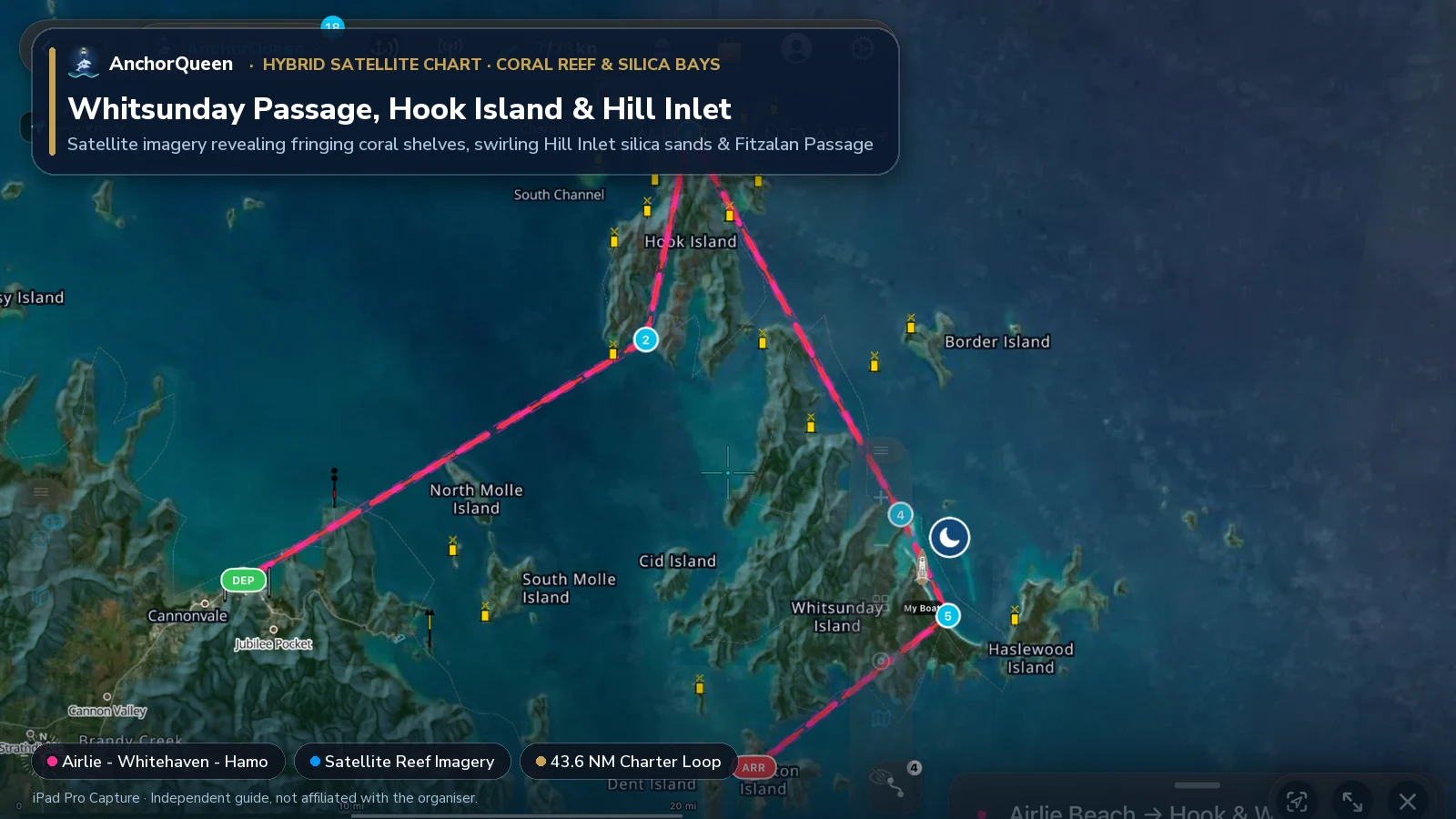
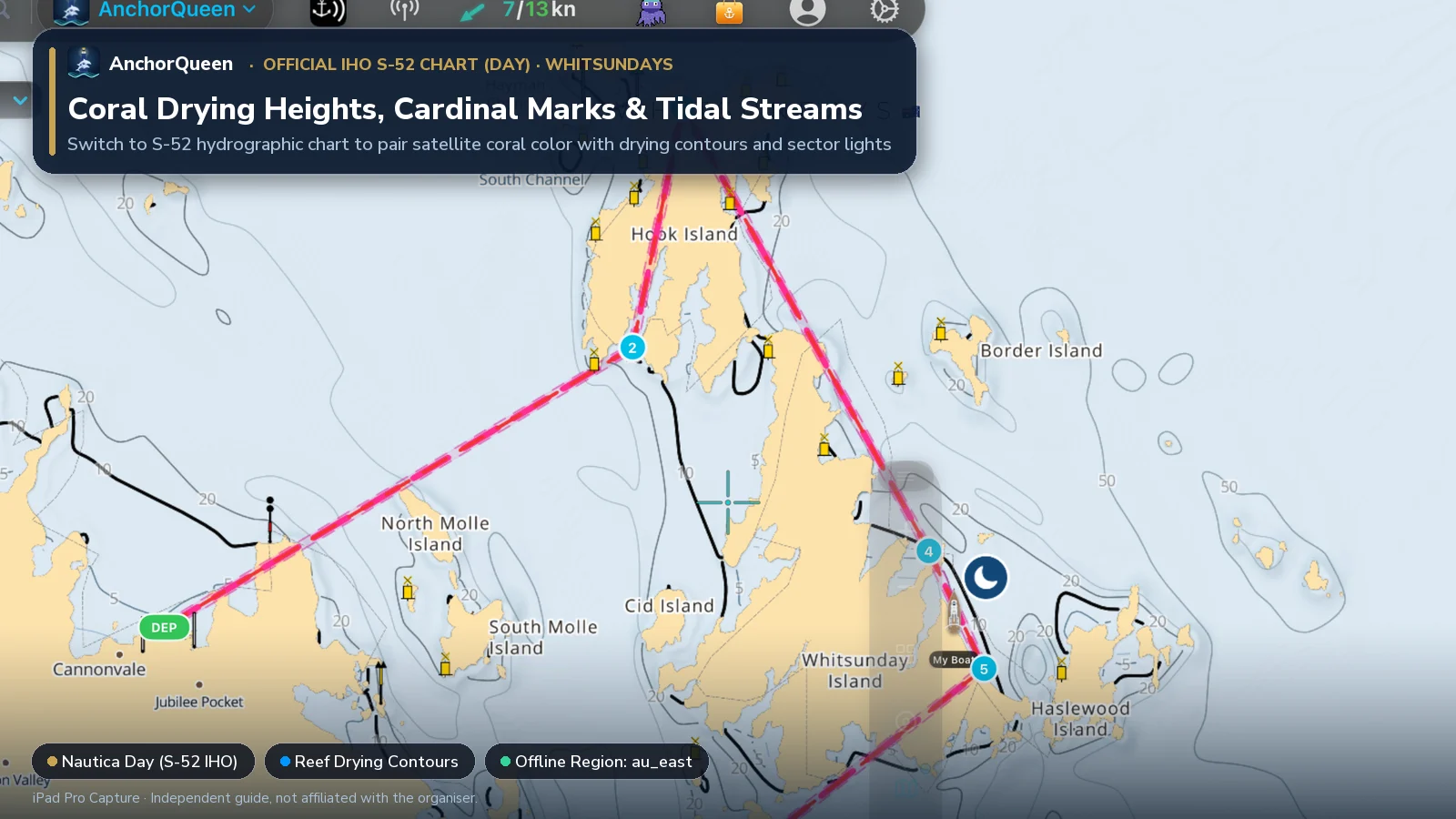
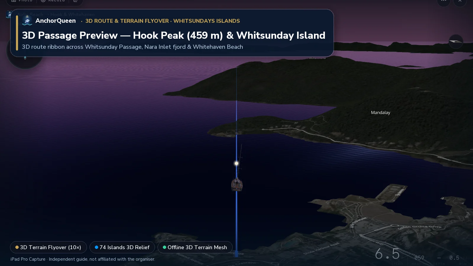
3D Route & Terrain Flyover
Tap 3D Terrain Flyover on the Route HUD to fly the 43.6 NM island loop in 3D across Whitsunday Passage, around the 459 m peak of Hook Island, and down Whitehaven Beach to Hamilton Island:
Essential Whitsundays rules: Reef Zoning, Moorings & Big Tides
1. Great Barrier Reef Marine Park (GBRMPA) Zoning
All of the Whitsundays sit inside the Great Barrier Reef Marine Park and the Queensland Great Barrier Reef Coast Marine Park, divided into colour-coded zones:
2. Four-metre tides & fast island passages
Many visiting skippers are surprised that the Whitsundays experience spring tidal ranges of up to 4.0 metres, driving 2 to 3.5 knot tidal streams through narrow bottlenecks such as Hook Passage, Solway Passage, Fitzalan Passage and Safe Passage.
3. Daily "Sked" VHF radio checks & stinger/shark safety
Bareboat charter fleets in the Whitsundays participate in mandatory morning and afternoon VHF radio schedules ("skeds") reporting each boat's overnight anchorage and next-day plan. Follow Queensland Parks and Wildlife Service advisories: never swim in Cid Harbour, never swim at dusk or dawn, and wear a full-body Lycra stinger suit between November and May.
Offline reef charts & SafeAnchor in the Whitsundays
Inside the high granite headlands of Nara Inlet, Macona Inlet and the eastern bays of Whitsunday Island, mobile coverage drops out.
Download AnchorQueen free on the App Store · Android: join the Poseidon Android beta · Compare Coral Sea Marina charter boats
Safety note
This guide is for planning only. Coral grows, sand cays shift, and electronic charts are an aid to visual pilotage—always approach coral reefs in good overhead sunlight (10:00 to 15:00) with a bow lookout wearing polarized sunglasses. Follow official GBRMPA zoning maps, Bureau of Meteorology tropical cyclone warnings, and your charter operator's briefing instructions at all times.