Two drowned river valleys sit less than twenty nautical miles apart on the central coast of New South Wales, yet they feel a world away on the water. Sydney Harbour (Port Jackson) puts you under the arch of the Harbour Bridge and the sails of the Opera House, weaving between ferry lanes, sandstone headlands and more than 6,100 registered moorings. Eighteen miles north along the Northern Beaches cliffs, rounding Barrenjoey Head opens Broken Bay, Pittwater and the Hawkesbury River—a sheltered maze of eucalyptus-lined fjords inside Ku-ring-gai Chase National Park with over 3,000 moorings and deep, quiet coves.
Whether you are picking up a charter yacht in Rushcutters Bay or Church Point, cruising your own keelboat for the southern summer, or planning to watch the Boxing Day start of the Sydney Hobart offshore race from the water, this guide covers the bases, a seven-day loop connecting both waterways, NSW Maritime mooring rules, and how to handle the afternoon Southerly Buster wind change.
Quick facts & season
The New South Wales cruising calendar peaks from November through April, when afternoon north-easterly sea breezes ("the Nor'easter") blow 15 to 22 knots and water temperatures climb to 21–24°C. Winter (May to September) brings crisp, sunny days and predominantly westerly offshore winds that flatten the coastal swell.
| Cruising overview | Sydney Harbour, Pittwater & Hawkesbury (NSW) |
|---|---|
| Peak cruising season | November to April (Southern Hemisphere summer); year-round sheltered sailing |
| Typical summer breeze | Afternoon NE sea breeze (15–22 kt), punctuated by cold-front Southerly Busters (25–35+ kt) |
| Distance between heads | ~18 nm from North Head (Sydney) to Barrenjoey Head (Broken Bay) |
| Tidal range & streams | Semi-diurnal, ~1.2 m to 2.0 m spring range; 1.5–3 kt tidal streams in the Hawkesbury River |
| Charter bases & marinas | Rushcutters Bay, The Spit, Birkenhead Point (Sydney); Church Point, Newport, Akuna Bay (Pittwater); Brooklyn (Hawkesbury) |
| Offline chart pack | Australia — East & Great Barrier Reef (AusBathyTopo + seamarks) |
Marinas & charter bases
New South Wales has more than 240,000 registered vessels, and berth demand in summer is high. If you are flying in to charter or booking a visitor berth, two main clusters serve this coast:
A 7-day itinerary: Sydney Harbour to Pittwater & Cowan Creek
This ~92 nm loop starts and finishes in Sydney Harbour, combining iconic city anchorages with four days inside the bushland fjords of Pittwater and Cowan Creek. If you charter directly out of Church Point or Newport in Pittwater, you can skip the coastal passages and spend the full week exploring Broken Bay, Brisbane Water and the Hawkesbury.
Clear the main ferry channels off Circular Quay, sail past Fort Denison and round Middle Head. Drop the hook off Athol Bay (below Taronga Zoo, watching the cable cars and the city skyline at dusk) or pass through The Spit Bridge opening into Sugarloaf Bay and Bantry Bay for flat-water overnight shelter.
Check the Bureau of Meteorology (BoM) coastal forecast, exit between North and South Head on a settled morning, and sail 18 nm north along the sandstone cliffs of Manly, Long Reef (stand well seaward of the reef bombora) and Palm Beach. Round Barrenjoey Head (113 m lighthouse) into Pittwater and pick up a mooring or anchor off Coasters Retreat / The Basin.
Cross the throat of Broken Bay past Lion Island into Cowan Creek. Anchor in mud and sand inside Refuge Bay (complete with a seasonal waterfall dropping onto the beach after rain) or tuck around the corner into America Bay.
Wind deeper into the steep, flooded valleys of Ku-ring-gai Chase National Park. Smiths Creek and Jerusalem Bay offer near-total protection from ocean swell, surrounded by eucalyptus forest, sacred Aboriginal rock engravings and walking tracks to Cowan station.
Ride a fair tide past Juno Point toward Dangar Island and Brooklyn for fuel, water and ashore dining, then drop back downriver to Patonga Creek or Flint and Steel Bay for the night.
Return into Pittwater for a relaxed sail past Scotland Island. Provision ashore at Church Point or Newport, and spend the evening on the western shore at Morning Bay or Towlers Bay.
Catch the morning land breeze or early sea breeze south down the Northern Beaches back through Sydney Heads. Pause for lunch anchored off Quarantine Beach (North Head) or Store Beach before returning to your Sydney Harbour berth.
Creating the Route with Jules AI & Waypoint-by-Waypoint Breakdown
Before casting off from Rushcutters Bay for the coastal hop to Pittwater, you can ask Jules AI in AnchorQueen to generate a depth-aware route with waypoints, clearing bearings, and shore highlights:
Prompt to Jules AI: "Jules, plan a coastal passage from Rushcutters Bay in Sydney Harbour up to The Basin in Pittwater for a 1.9 m draft yacht at 6.5 kn. Give me the key waypoints, depths, and things to do."
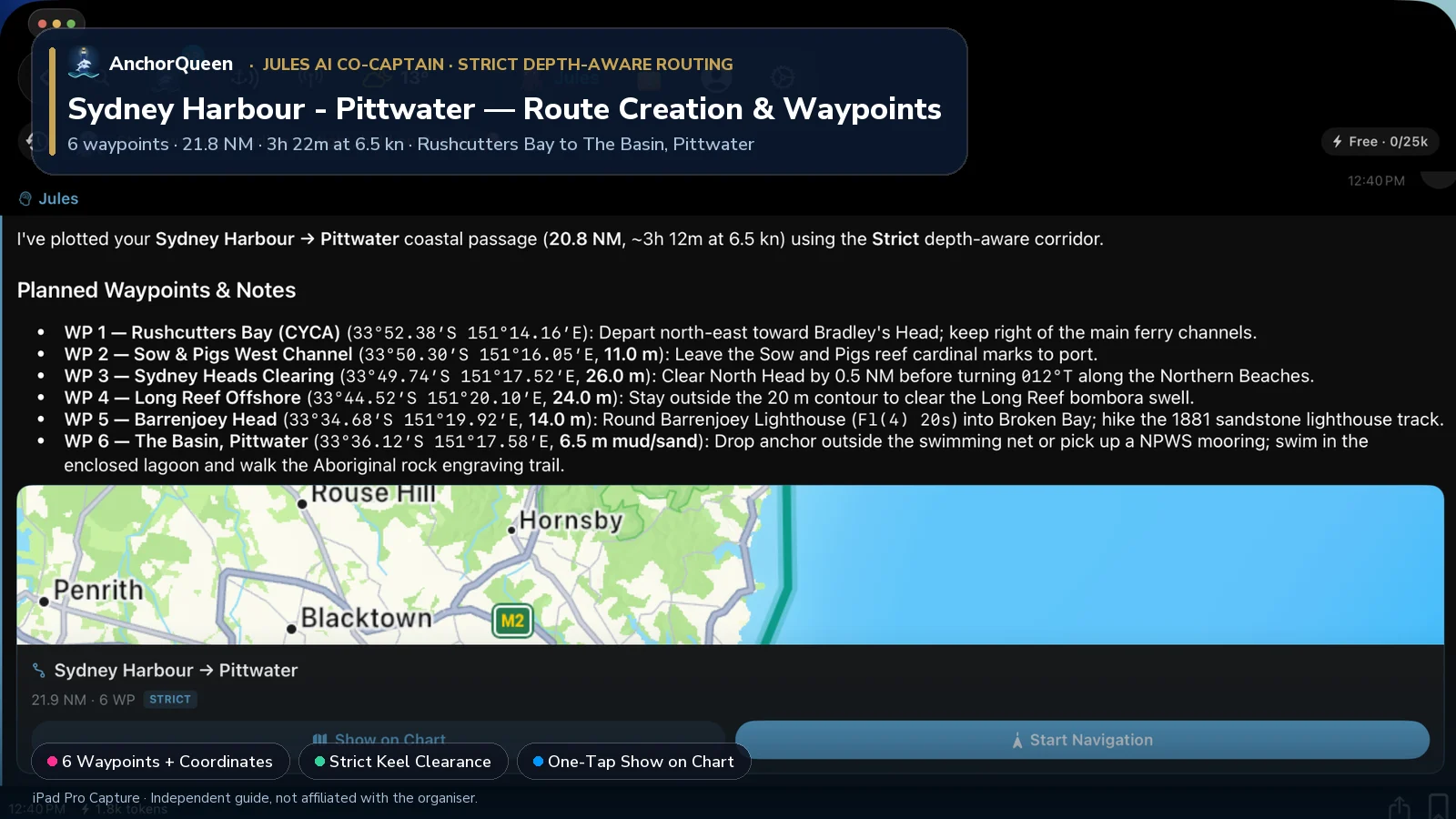
Planned Waypoints, Coordinates & Things to Do
| WP # | Waypoint & Coordinates | Course & Leg | Depth & Holding | Things to Do Ashore & On the Water |
|---|---|---|---|---|
| WP 1 | Rushcutters Bay (CYCA)33°52.38′S 151°14.16′E | Departure berth | 4.5 m marina / mud | Provision in Potts Point, walk the Rushcutters Bay foreshore park, and check the CYCA race boards before slipping lines. |
| WP 2 | Sow & Pigs West Channel33°50.30′S 151°16.05′E | 036°T · 2.5 NM | 11.0 m sand | Pass west of the Sow and Pigs Reef cardinal marks; look across to historic Watson's Bay, Camp Cove beach, and Hornby Lighthouse on South Head. |
| WP 3 | Sydney Heads Clearing33°49.74′S 151°17.52′E | 065°T · 1.3 NM | 26.0 m sand/rock | Clear the 90 m sandstone cliffs of North Head by 0.5 NM before turning north; spot migrating humpback whales (May–Nov) or drop into Quarantine Beach for a sheltered lunch hook. |
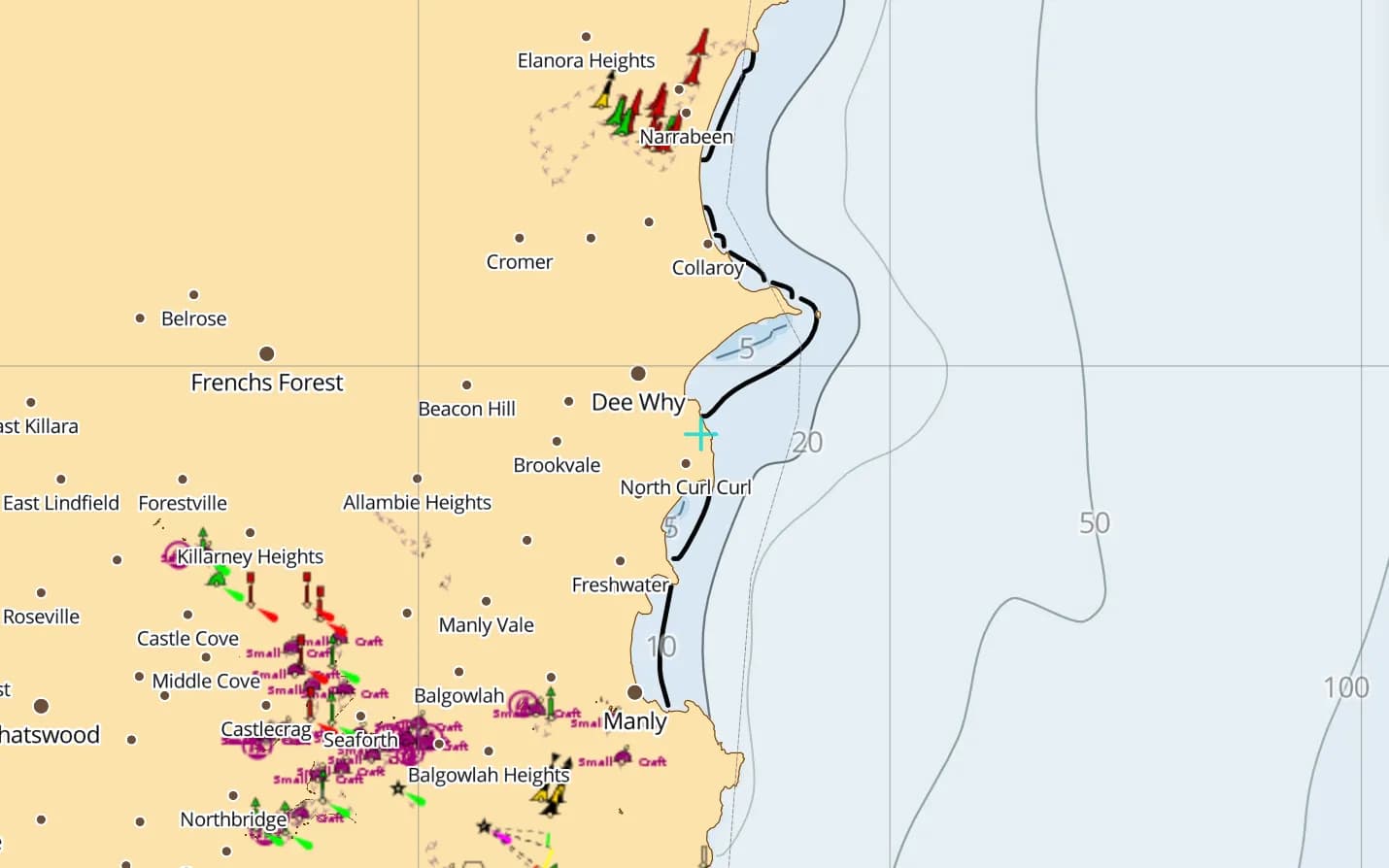
| WP 4 | Long Reef Offshore33°44.52′S 151°20.10′E | 012°T · 5.6 NM | 24.0 m shelf | Stay outside the 20 m contour to clear the Long Reef bombora swell; enjoy panoramic beam-reach views past Manly, Freshwater, and Collaroy beaches. |
| WP 5 | Barrenjoey Head33°34.68′S 151°19.92′E | 359°T · 9.8 NM | 14.0 m sand | Round the 1881 sandstone Barrenjoey Lighthouse (Fl(4) 20s) into Broken Bay; anchor inside Station Beach (Palm Beach) and hike the Smugglers Track to the lighthouse summit. |
| WP 6 | The Basin, Pittwater33°36.12′S 151°17.58′E | 235°T · 2.4 NM | 6.5 m mud/sand | Pick up an NPWS public mooring or anchor outside the swimming net in Ku-ring-gai Chase National Park; swim in the enclosed lagoon, see swamp wallabies on the lawn, and walk the Aboriginal rock engraving trail. |
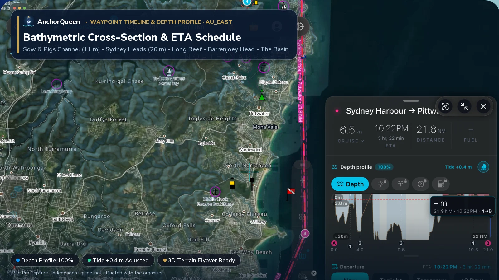
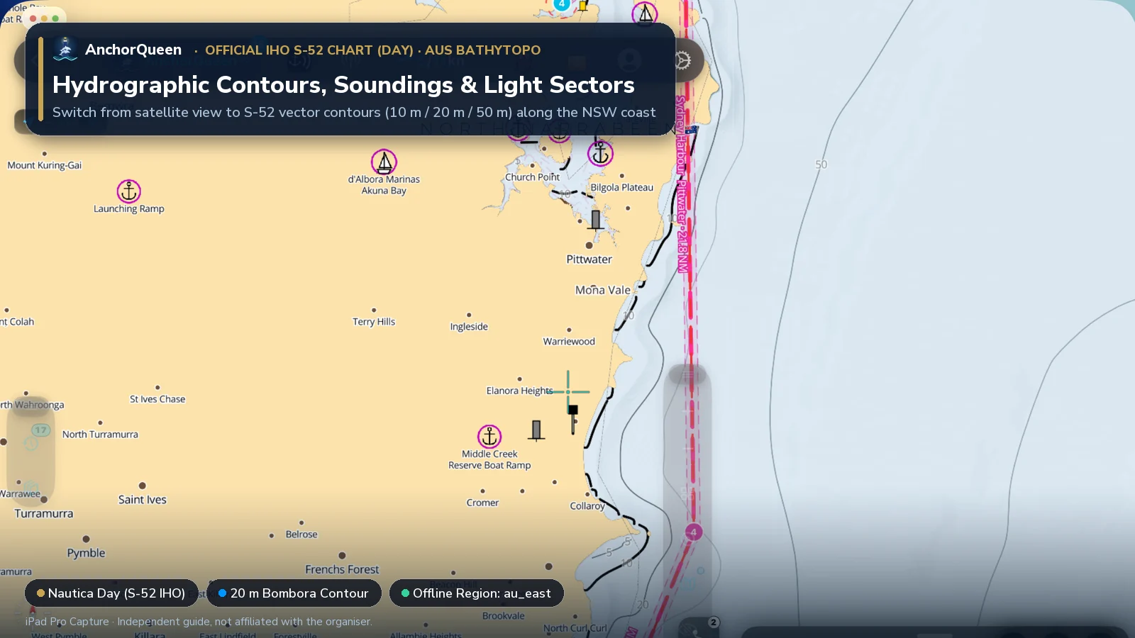
Switching Chart Types: Hybrid Satellite vs. Official S-52 Hydrographic Chart
Switching chart layers in AnchorQueen lets you cross-check visual reef edges against official hydrographic contours:
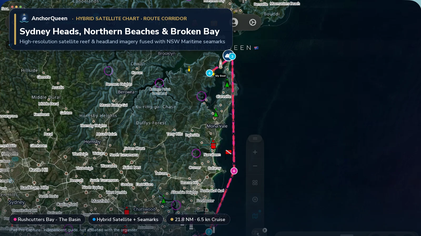
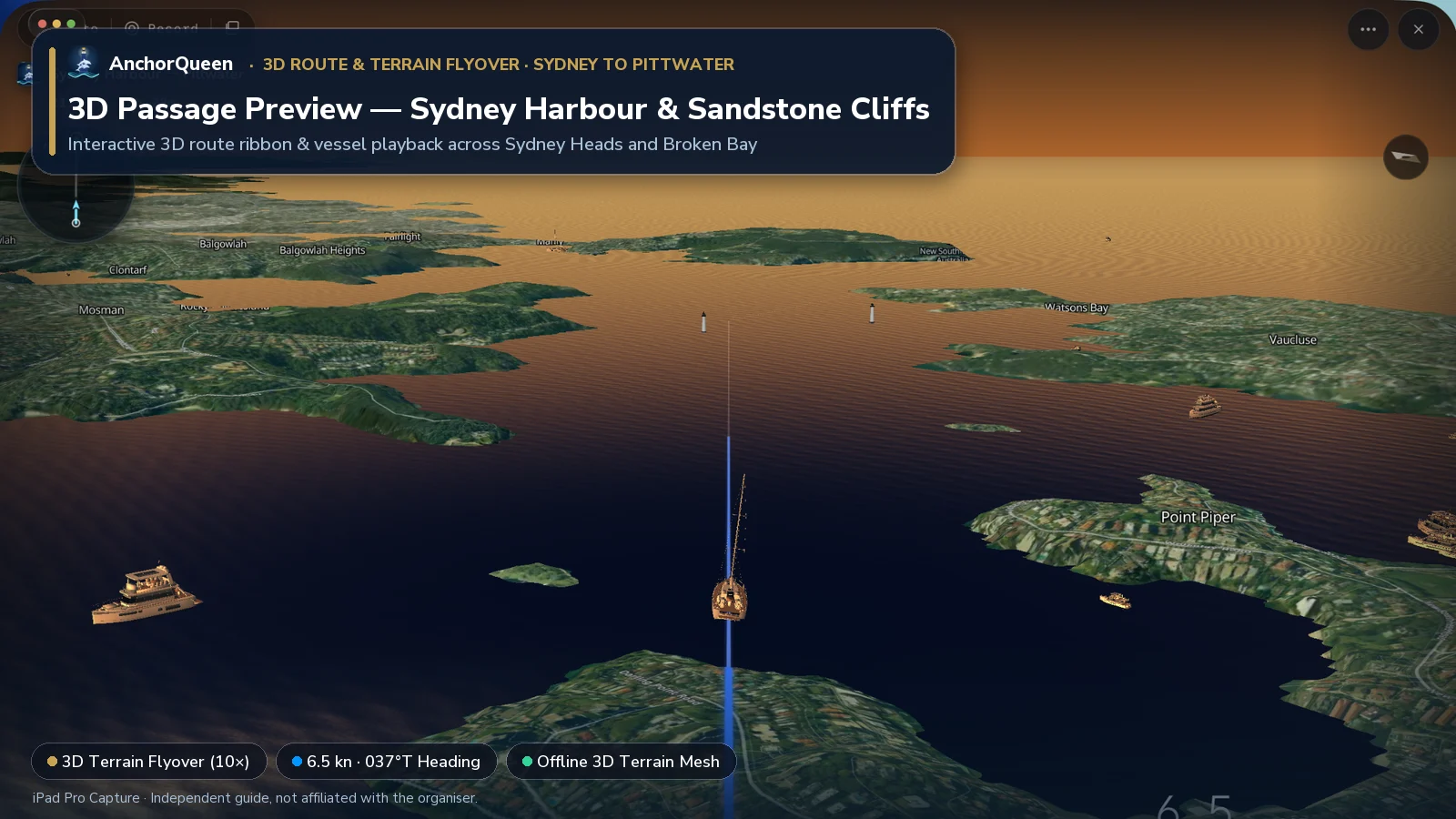
3D Route & Terrain Flyover
Before leaving the dock—or while briefing your crew in the cockpit—tap 3D Terrain Flyover on the Route HUD to preview the entire 21.8 NM passage in 3D over offline elevation mesh and satellite imagery:
Seamanship & local rules to know
1. NSW Maritime courtesy moorings vs private moorings
Both Sydney Harbour and Pittwater have dense mooring fields managed under Transport for NSW Maritime.
2. The "Southerly Buster" wind shift
On hot summer afternoons, a trough moving up the southern New South Wales coast triggers the classic Southerly Buster: within ten minutes, a warm 18-knot north-easterly sea breeze can collapse and be replaced by a 30-to-40-knot southerly gale accompanied by a roll cloud and a 10°C temperature drop.
3. Sydney Harbour ferry priority & exclusion zones
Sydney Harbour is a working commercial port. Keep a sharp lookout for green-and-gold Sydney Ferries and high-speed Manly fast ferries—especially across the Sow and Pigs Reef channels, Bradleys Head and Circular Quay. Commercial vessels operating in main channels have priority, and anchored pleasure craft must stay well clear of submarine cable zones and ferry approaches.
Watching the Boxing Day Sydney Hobart start (26 December)
Every year on 26 December (Boxing Day) at 13:00 AEDT, more than a hundred offshore racing yachts line up in Sydney Harbour for the 628-nautical-mile passage to Hobart, Tasmania. (Read our independent Sydney Hobart race & course guide for stage-by-stage tactical breakdowns and cliff viewpoints; AnchorQueen has no official affiliation or partnership with the race or its organisers.)
If you are watching from your own or a chartered yacht on Sydney Harbour:
Planning & anchoring with AnchorQueen
In the deep sandstone gorges of Cowan Creek, Smiths Creek and the upper Hawkesbury River, high valley walls often block mobile phone reception completely.
Download AnchorQueen free on the App Store · Android: join the Poseidon Android beta · Browse Australia yacht charters
Safety note
This guide is an independent planning resource only. Distances and depths are approximate, mooring time limits and exclusion zones change seasonally, and coastal bars and headlands can become hazardous in onshore swell. Always consult official Australian Hydrographic Office / NSW Maritime charts and notices, monitor Bureau of Meteorology warnings, and maintain a proper watch. Navigation apps support your seamanship; they do not replace it.