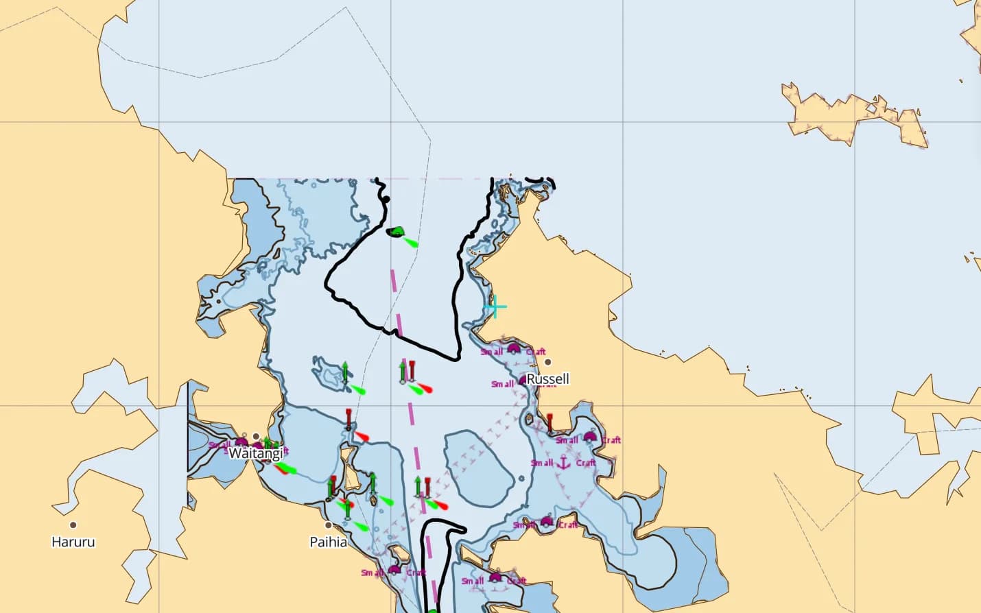
One hundred and thirty nautical miles north of Auckland, the east coast of Northland opens into the Bay of Islands (Pewhairangi)—a deeply indented drowned valley containing 144 islands, turquoise lagoons, historic Russell townships and the sheltered deep-water reaches of the Veronica Channel. At its head sits Opua, New Zealand's primary northern port of entry for international South Pacific cruising yachts as well as the main charter jump-off alongside Paihia.
Because the outer chain of Motuarohia, Moturua, Motukiekie and Urupukapuka islands breaks the Pacific swell while keeping passages down to two to five miles between bays, you can sail for a week without repeating an anchorage—or push twenty-five miles north past the Cavalli Islands into the dramatic volcanic canyon of Whangaroa Harbour.
Quick facts & season
Northland enjoys New Zealand's warmest maritime climate ("the Winterless North"). The peak cruising and charter window runs from December through April, when water temperatures reach 20–23°C and afternoon sea breezes average 12 to 18 knots.
| Cruising overview | Bay of Islands & Northland Coast (NZ) |
|---|---|
| Peak cruising season | December to April (subtropical summer & autumn); mild winter cruising May–November |
| Prevailing wind | SW–W 10–18 kt and afternoon NE sea breeze; watch for subtropical easterlies in late summer |
| Tidal range | ~1.6 m to 2.4 m spring range at Opua; moderate tidal streams in the Veronica Channel |
| Primary marinas & bases | Bay of Islands Marina, Opua (420 berths + 34 moorings); Paihia Marina; Russell moorings |
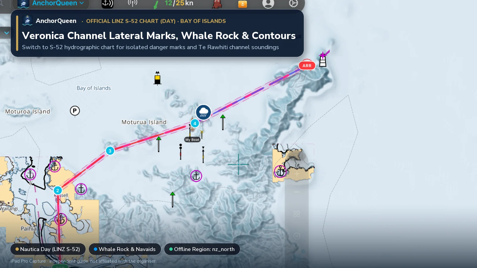
| Official chart source | LINZ Hydrographic ENC (New Zealand North offline pack) |
| Charter listings | Compare Opua / Paihia & NZ yachts on New Zealand yacht charter |
Opua, Paihia & Russell: Bases and Port of Entry
A 7-day itinerary: The 144 Islands & Whangaroa Fjord
This ~85 nm itinerary starts at Opua or Paihia. Days 1–4 and Day 7 stay inside the sheltered Bay of Islands; Days 5–6 offer an optional 26 nm coastal extension north to the Cavalli Islands and Whangaroa Harbour for settled weather.
Cast off down the Veronica Channel and drop anchor off Russell (or pick up a visitor mooring in adjacent Matauwhi Bay, home to the Russell Boating Club) for an easy first evening ashore.
Make a morning stop off the twin turquoise lagoons of Motuarohia (Roberton Island) to climb the lookout track for the classic panorama of the bay, then hop across to Waiiti Bay or Otakairangi Bay on Moturua Island for the night (check current Biosecurity NZ Caulerpa rules before anchoring—see below).
Sail east through the island passages to Urupukapuka, the largest island in the group. Walk the ridge trails across archaeological pā sites and native bird habitats.
Push out along the rugged Rawhiti peninsula to Deep Water Cove (near the HMNZS Canterbury dive wreck, where anchoring is prohibited inside the wreck reserve marker buoys) and view the 1910 Cape Brett Lighthouse and Piercy Island (Motukōkako / the "Hole in the Rock").
In settled southwest or light conditions, sail northwest past Ninepin Rock and the Cavalli Islands (Motukawanui), then thread the narrow 250-metre cliff entrance into Whangaroa Harbour—a near-landlocked volcanic fjord ringed by towering conglomerate rock domes (St Paul's Rock and Taratara). Anchor in Pekapeka Bay or Rere Bay off Lane Cove.
Exit Whangaroa in the morning and enjoy a downwind or beam-reach sail back into the northern Bay of Islands, anchoring beneath Tapeka Point or inside the western arm toward Moturoa Island.
Sail past the Waitangi Treaty Grounds for a final lunch hook before returning up the Veronica Channel to the fuel dock at Opua.
Creating the Route with Jules AI & Waypoint-by-Waypoint Breakdown
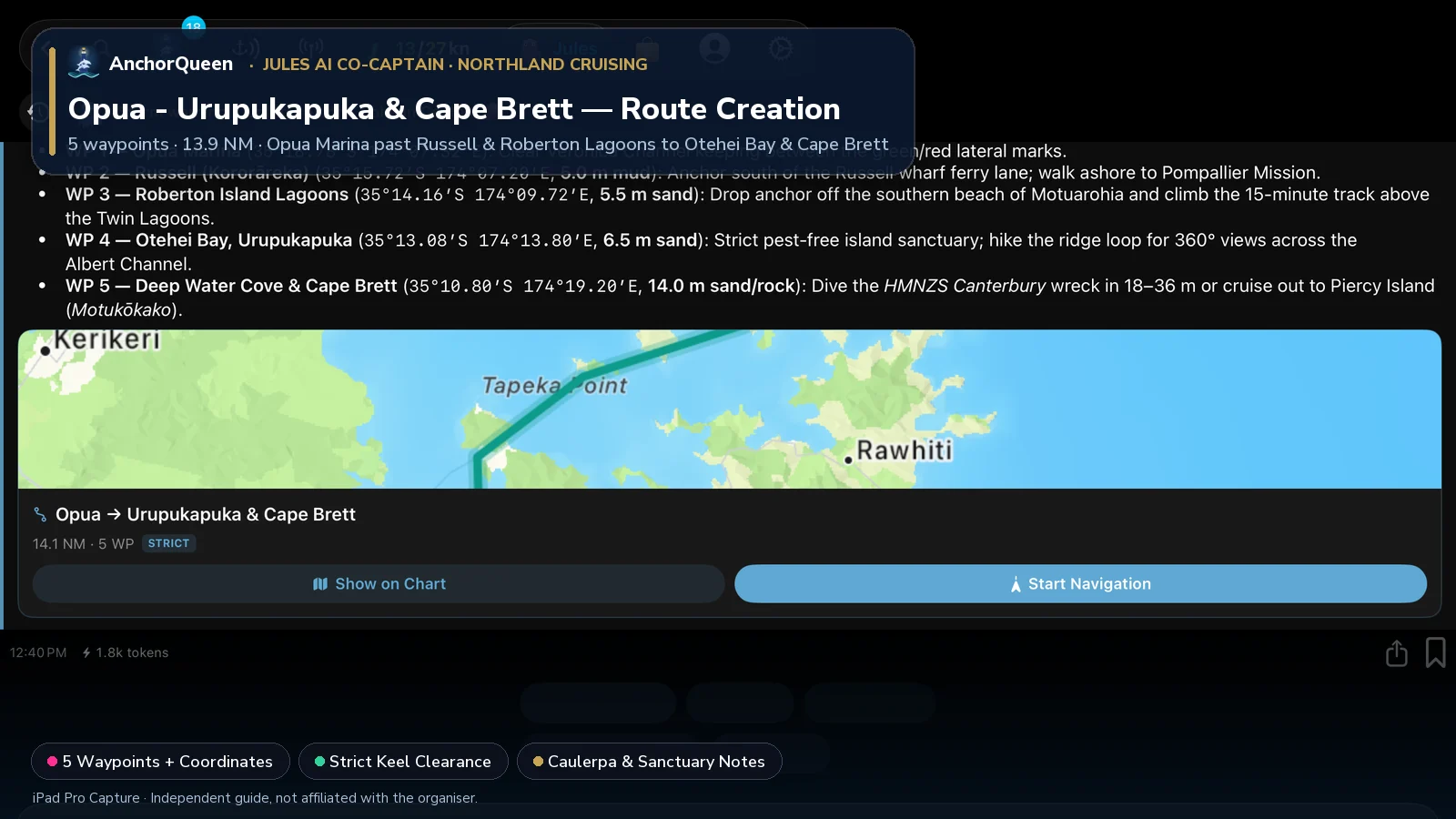
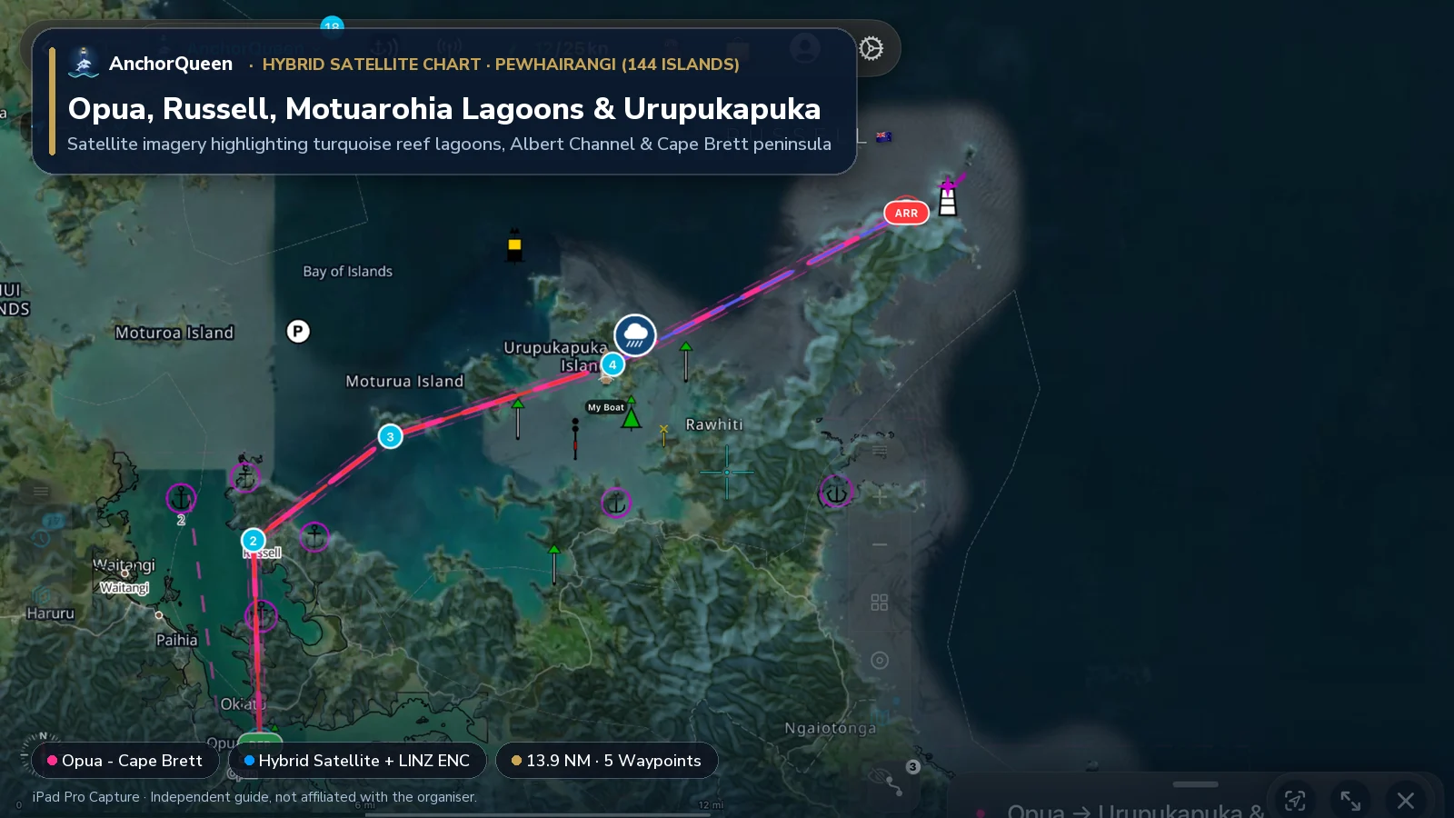
To thread from the Opua Marina fuel dock through the Veronica Channel out to Russell, Motuarohia, Urupukapuka Island and Cape Brett, ask Jules AI in AnchorQueen to build a depth-aware route with waypoints and shore stops:
Prompt to Jules AI: "Jules, build a Bay of Islands cruising route from Opua Marina to Russell, Roberton Island, Urupukapuka Island, and Cape Brett. Include waypoints and shore activities."
Planned Waypoints, Coordinates & Things to Do
| WP # | Waypoint & Coordinates | Course & Leg | Depth & Holding | Things to Do Ashore & On the Water |
|---|---|---|---|---|
| WP 1 | Opua Marina35°18.78′S 174°07.32′E | Departure berth | 4.0 m marina | Top up fuel and water, check the current Biosecurity NZ Exotic Caulerpa map, and depart north down the buoyed Veronica Channel. |
| WP 2 | Russell (Kororāreka)35°15.72′S 174°07.20′E | 358°T · 3.1 NM | 5.0 m mud | Anchor south of the ferry lane or pick up a visitor mooring; walk ashore to the 1842 Pompallier Mission, climb Flagstaff Hill (Maiki), and dine at the historic Duke of Marlborough. |
| WP 3 | Roberton Island Lagoons35°14.16′S 174°09.72′E | 053°T · 2.6 NM | 5.5 m sand | Day stop off Motuarohia (Roberton Island) (check 5 kn Marine Mammal Safe Zone & Caulerpa rules); climb the 15-minute track above the Twin Lagoons and snorkel the Underwater Trail. |
| WP 4 | Otehei Bay, Urupukapuka35°13.08′S 174°13.80′E | 072°T · 3.5 NM | 6.5 m sand | Pest-free island sanctuary under Project Island Song; hike the archaeological pā ridge loop for 360° views across the 144 islands, rent a beach kayak, and listen for tieke (saddlebacks). |
| WP 5 | Deep Water Cove & Cape Brett35°10.80′S 174°19.20′E | 063°T · 5.0 NM | 14.0 m sand/rock | Dive the HMNZS Canterbury frigate wreck in 18–36 m (no anchoring inside the wreck reserve markers) and cruise out to Piercy Island (Motukōkako / Hole in the Rock). |
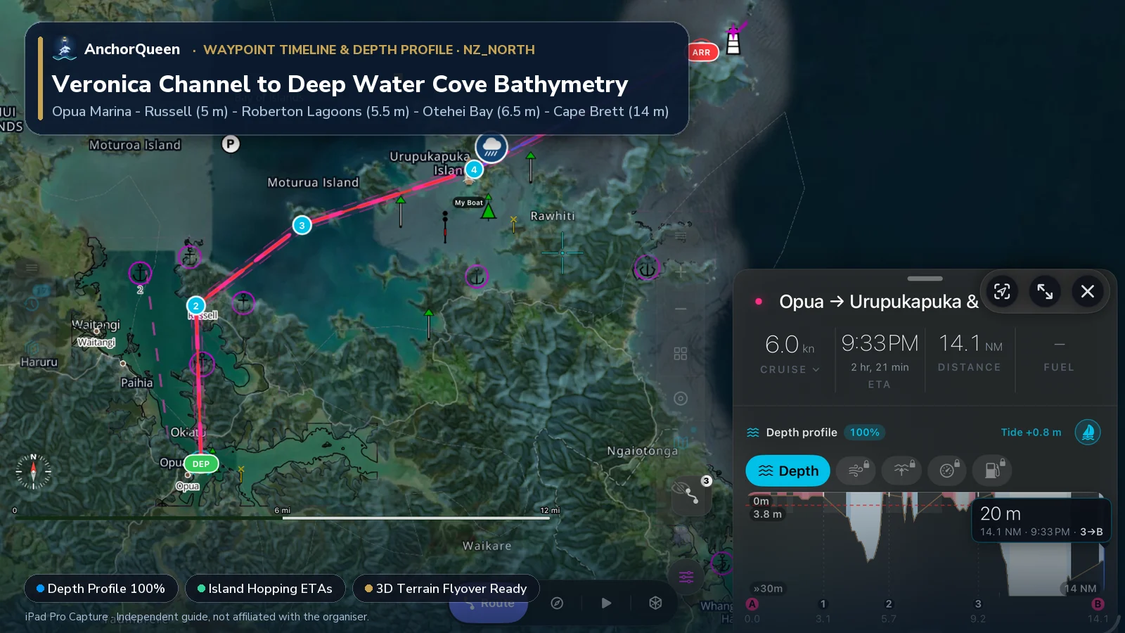
Switching Chart Types: Hybrid Satellite vs. Official LINZ S-52 Chart
Switching chart modes in the Bay of Islands makes island pilotage effortless:
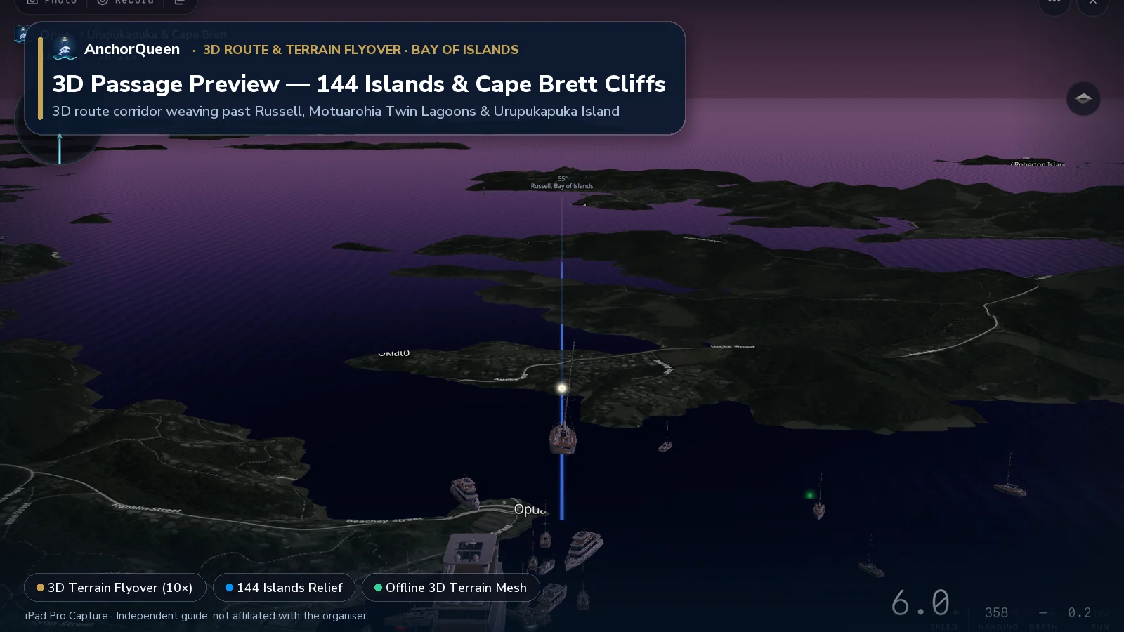
3D Route & Terrain Flyover
Tap 3D Terrain Flyover on the Route HUD to fly the 13.9 NM passage in 3D from the Kawakawa River entrance past historic Russell and out along the rugged Cape Brett peninsula:
Critical local rules: Exotic Caulerpa & Marine Mammal Sanctuary
1. Te Rawhiti / Albert Channel Exotic Caulerpa Controlled Area
Since 2023, Biosecurity New Zealand (MPI) and Northland Regional Council have enforced a Controlled Area Notice (CAN) covering parts of the eastern Bay of Islands—centered around Te Rawhiti Inlet, the Albert Channel, Motuarohia, Moturua, Motukiekie and Urupukapuka Islands—to stop the spread of invasive exotic Caulerpa seaweed.
2. Bay of Islands Marine Mammal Sanctuary
The Bay of Islands is a gazetted Marine Mammal Sanctuary protecting bottlenose dolphins (terehu) and visiting whales:
Late January highlight: Bay of Islands Sailing Week
During the fourth week of January (24–28 January 2027), Bay of Islands Sailing Week brings more than a hundred keelboats, sportsboats, TP52s and multihulls to Opua and the central bay for four days of island and windward-leeward racing. (Independent spectator note—AnchorQueen has no official partnership or affiliation with the regatta.)
Offline LINZ charts & SafeAnchor in Northland
If you venture north into the narrow rocky jaws of Whangaroa Harbour or behind the headlands of Cape Brett, steep cliffs block mobile data.
Download AnchorQueen free on the App Store · Android: join the Poseidon Android beta · Browse New Zealand yacht charters
Safety note
This guide is for planning only. Distances and depths are approximate, Exotic Caulerpa Controlled Area boundaries and Marine Mammal Sanctuary rules carry legal penalties and change over time, and coastal passages require up-to-date weather and official LINZ charts. Always check current Biosecurity New Zealand, Northland Regional Council Harbourmaster and MetService notices before you sail.