US West Coast & Hawaii haritaları — gerçekte nasıl seyrettiğinize göre tasarlandı
San Diego'dan San Juans'a Pasifik kıyısı, üstüne Hawaii.

Popüler yelken rotaları
Bu bölgenin denizcilerinin gerçekten demir attığı yerler.
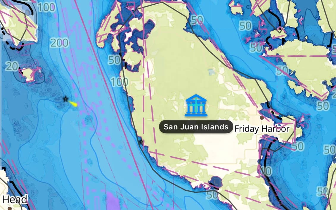
San Juan Adaları ve Puget Sound
Pasifik Kuzeybatı'da korunaklı ada seyri, büyük gelgitler ve katil balina suları.
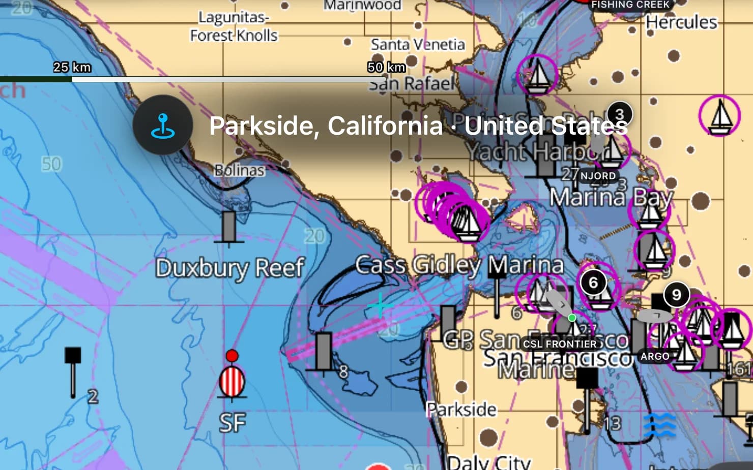
San Francisco Körfezi
Golden Gate altında öğleden sonra batı rüzgârı — dünya çapında günübirlik yelken.
Channel Islands
Santa Cruz, Santa Rosa ve Catalina — Güney Kaliforniya açıklarında vahşi bir günübirlik sıçrama.
Hawaii
Büyük açık deniz ödülü — ada zinciri boyunca alize rüzgârı demir yerleri.
Popüler limanlar ve demir yerleri
US West Coast denizcilerinin seyrettiği yerlerden birkaçı — hepsi pakette haritalandı.
- The San Juan Islands
- Friday Harbor
- Puget Sound
- San Francisco Bay
- Sausalito
- Monterey
- The Channel Islands
- Catalina
- San Diego
- Honolulu
- Lahaina
US West Coast seyri
ABD Batı Kıyısı, Pasifik Kuzeybatı'nın korunaklı labirentlerinden Güney Kaliforniya'nın dalga dövdüğü plajlarına uzanır; Hawaii ise açık denizdeki ödüldür. San Juans ve Puget Sound, güçlü gelgit akıntılarıyla korunaklı ada seyri sunar; San Francisco Körfezi öğleden sonra batı rüzgârını toplar; Channel Islands ise Los Angeles yığınından bir gün açıkta yer alır. Bu bölge Kanada sınırından Meksika'ya Pasifik kıyısını ve Hawaii adalarını, ölçüm sınıfı haritalar üzerinde kapsar.
US West Coast paketinin içinde ne var
Harita hattımızın bu bölge için hazırladığı her katman — yılda $14.99 karşılığında sizin.
Nautica Gündüz ve Gece haritaları
Gündüz ve gece nöbetleri için biçimlendirilmiş S-52 vektör kartografisi.
Derinlik bilinçli rotalama
Su çekiminize ve haritalanan derinliklere saygı duyan rota planlama.
Taban ve tutuş
S-57 zemin verisinden taban türü ve tutma kalitesi — neyin üzerine demir attığını bil.
İskandiller ve derinlik konturları
Tüm bölge boyunca nokta derinlikleri ve konturlar.
Gelgitler ve akıntılar
Gelgit yükseklikleri ve akıntılar, pakete dahil.
Kayalıklar, batıklar ve tehlikeler
Temiz bir yaklaşım planlayabilmeniz için haritalanan engeller.
Limanlar ve demir yerleri
Kıyı boyunca marinalar, limanlar ve demir yerleri.
Fenerler, şamandıralar ve işaret fişekleri
Işık karakteristikleriyle birlikte haritalanan seyir yardımcıları.
Tamamen çevrimdışı
Bir kez wifi ile indirin; sinyal olmadan seyredin.
Kaynaklar ve doğruluk
US West Coast paketi NOAA ENC + GMRT + OSM SeaMarks kaynağından oluşturulur; toplulukça doğrulanmış kayalar, batıklar ve seyir yardımcılarıyla birleştirilir. NOAA ENC · GMRT · © OpenStreetMap contributors (ODbL)
- Hidrografik kalitede ENC
- 2,352 × 1,860 NM
- 1,620 MB
US West Coast bölgesinde demirleme
AnchorQueen her şeyden önce bir demir nöbeti uygulamasıdır. Her US West Coast haritası, resmî verilerden taban türünü ve tutma kalitesini taşır; böylece demir atmadan önce dibi okursun — sonra demir alarmı sen uyurken savrulmanı izler.
App Store hesabınız üzerinden güvenle faturalanan, otomatik yenilenen abonelik — kart formu yok, ayrı giriş yok. İstediğiniz zaman iptal edin.
Şimdi iPhone ve iPad’de — Android çok yakında.
Tüm uygulamada mı seyrediyorsunuz? Pro bir bölge içerir; Max üç bölge içerir.
Sorular
Hawaii dahil mi?
Evet — Hawaii adaları, Washington'dan Güney Kaliforniya'ya anakara Pasifik kıyısının yanı sıra kapsanır.
Pasifik Kuzeybatı gelgitleri ele alınıyor mu?
Evet — gelgit yükseklikleri ve akıntılar pakettedir, ki Puget Sound ve San Juans güçlü akıntılar gösterdiğinde bunlar önem kazanır.
Açık denizde çevrimdışı çalışır mı?
Evet — bir kez indirildikten sonra tamamen çevrimdışı, ki Channel Islands geçişinde ya da bir Hawaii geçişinde bu şarttır.