Aegean & East Mediterranean haritaları — gerçekte nasıl seyrettiğinize göre tasarlandı
Kikladlar'dan Türkiye kıyılarına — her ada haritalandı, hem de çevrimdışı.

Popüler yelken rotaları
Bu bölgenin denizcilerinin gerçekten demir attığı yerler.
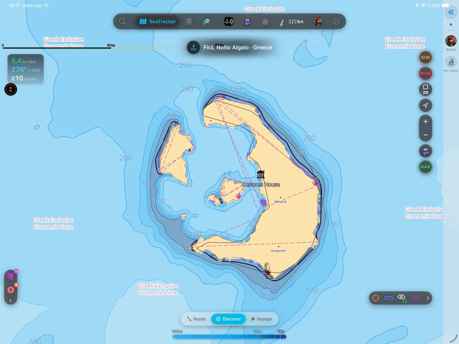
Santorini
Her charter'ın hayalini kurduğu kaldera demir yeri — derin, etkileyici ve yoğun. Demir atmadan önce derinliklerinizi bilin.
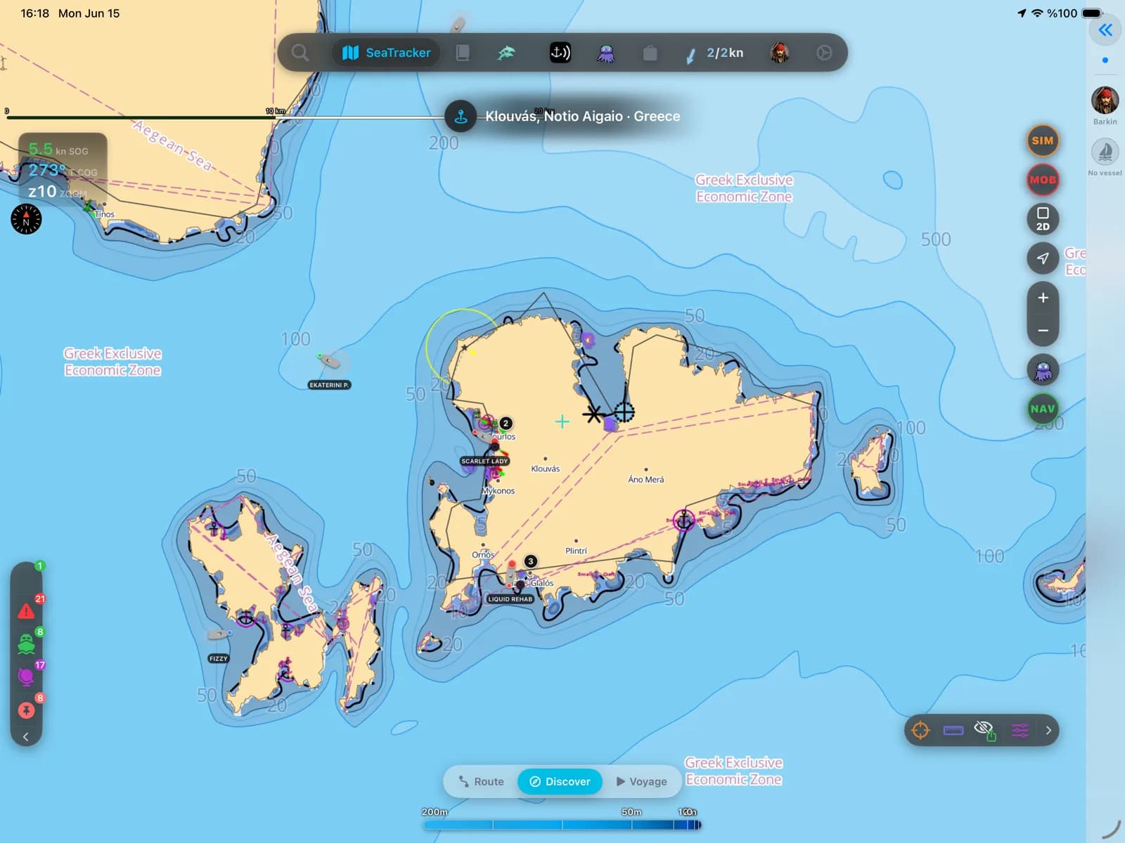
Mikonos
Kiklad gece hayatı ve meltemiye açık demir yerleri. Sert eserse Eski Liman'dan Ornos'a.
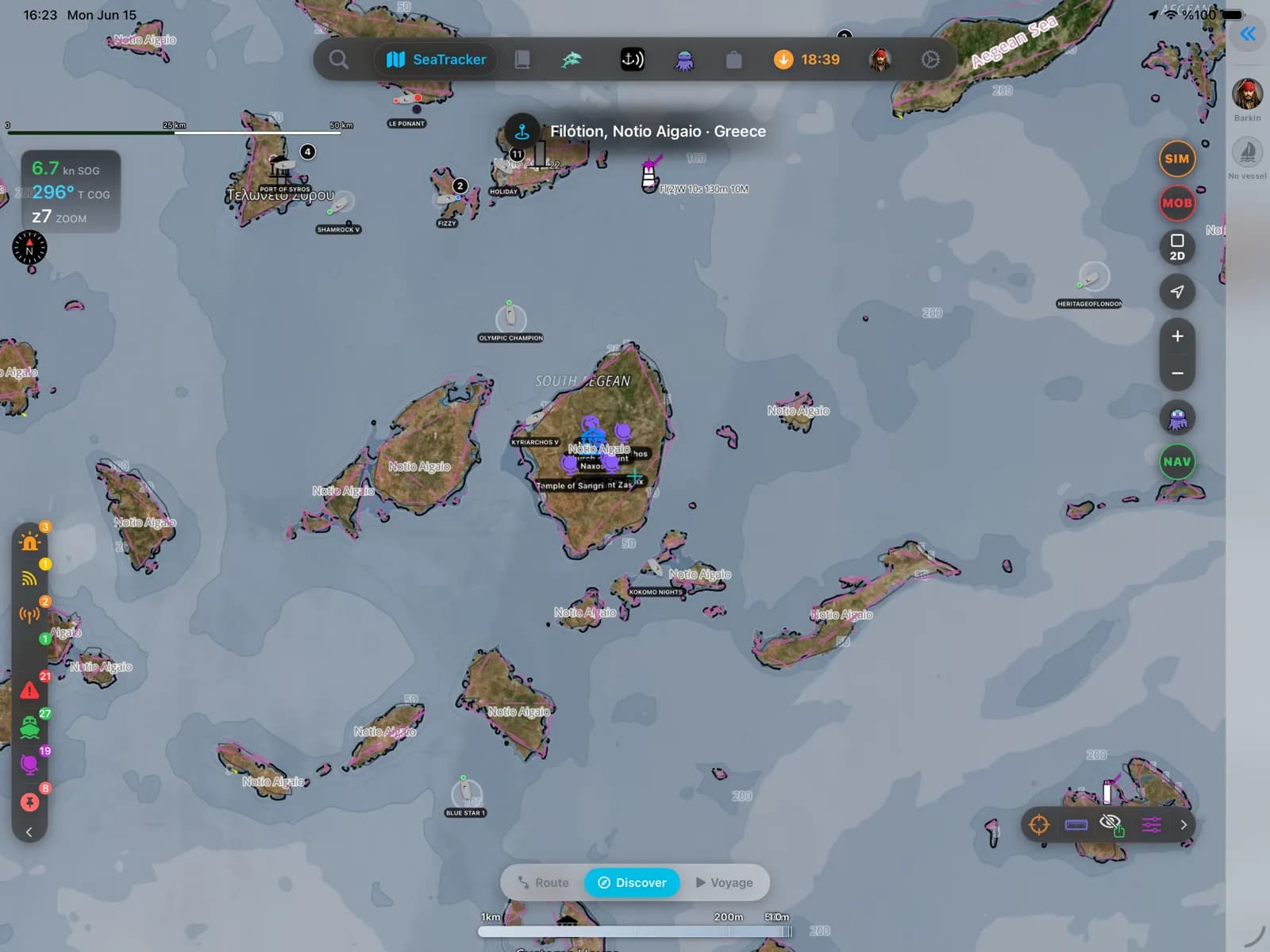
Naksos ve Paros
Kikladlar'ın seyir kalbi — korunaklı koylar, kısa etaplar, güvenilir meyhaneler.
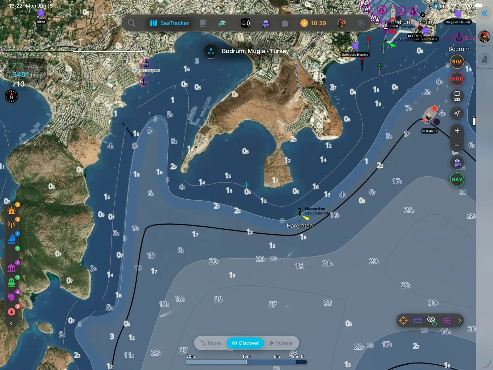
Bodrum ve Türkiye kıyısı
Guletler, çam kaplı koylar ve Bodrum yarımadasının koyu mavi girintileri — Ege'nin Türkiye yakası.
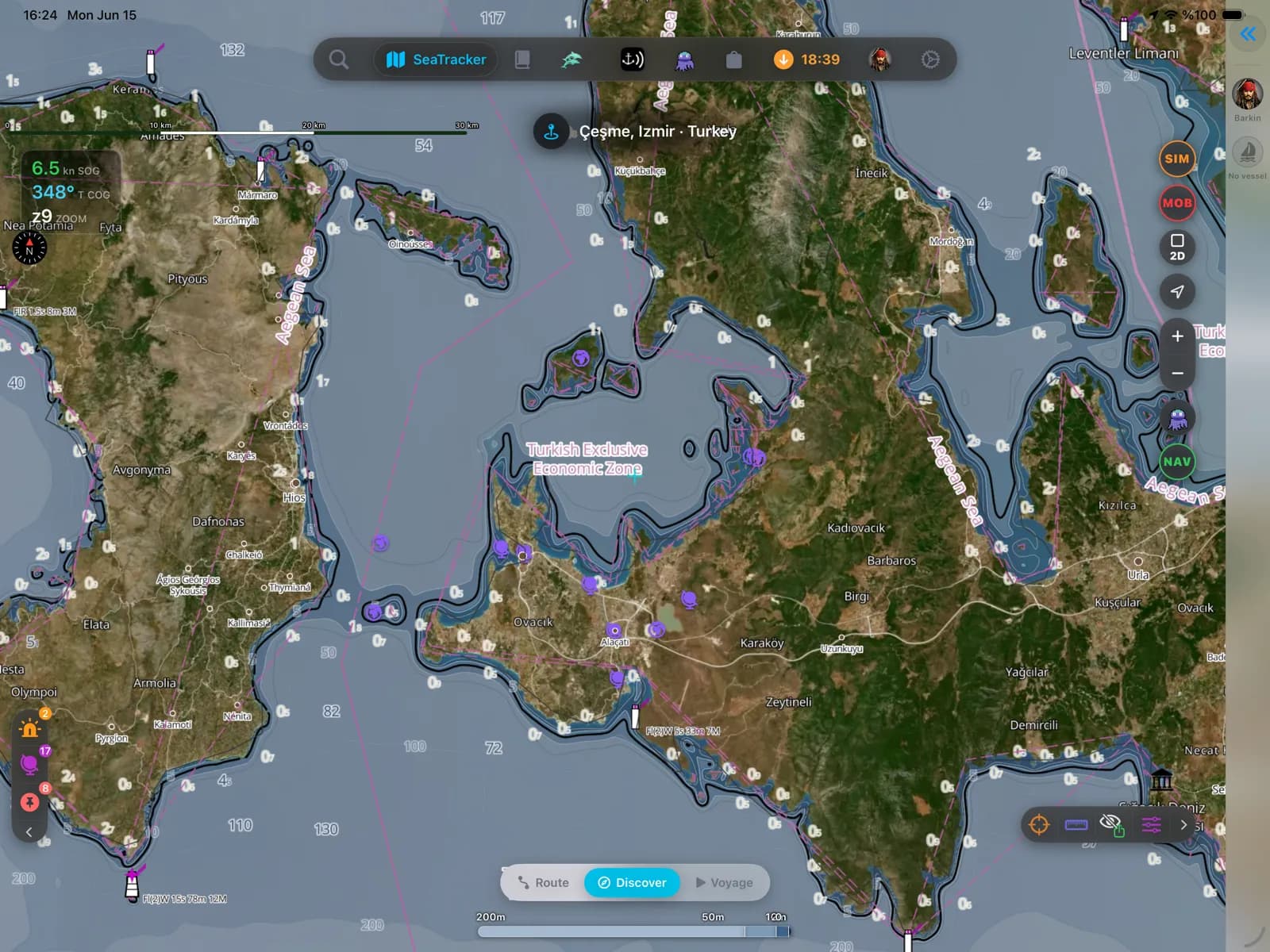
Çeşme ve Alaçatı
Rüzgârlı Alaçatı, Çeşme marinası ve Sakız Adası'na geçit — Ege'nin sörf köşesi.
Popüler limanlar ve demir yerleri
Aegean denizcilerinin seyrettiği yerlerden birkaçı — hepsi pakette haritalandı.
- Santorini
- Mykonos
- Naxos
- Paros
- Ios
- Milos
- Amorgos
- Symi
- Rhodes
- Kos
- Kalymnos
- Patmos
- Bodrum
- Göcek
- Fethiye
- Kekova
- Hydra
- Spetses
Aegean seyri
Ege, hazırlıklı olanı ödüllendirir. Yazın Meltemi rüzgârları Kikladlar arasından sert eser, Mikonos ve Santorini çevresinde feribot trafiği yoğundur ve en güzel demir yerlerinin çoğu — Polyaigos, Fourni geçitleri, Türkiye tarafında Kekova — pilot kitabından çok iyi bir harita ile derinliğe duyarlı bir yaklaşımın önem taşıdığı, işaretsiz koylardır. Bu bölge tüm Yunan Ege'sini, Türkiye'nin batı ve güney kıyılarını, Onikiada'yı ve Kıbrıs'ı kapsar; tam kapsamlı batimetri, topluluk tarafından doğrulanmış kayalıklar, batıklar ve seyir yardımcılarıyla harmanlanmıştır.
Aegean paketinin içinde ne var
Harita hattımızın bu bölge için hazırladığı her katman — yılda $14.99 karşılığında sizin.
Nautica Gündüz ve Gece haritaları
Gündüz ve gece nöbetleri için biçimlendirilmiş S-52 vektör kartografisi.
Derinlik bilinçli rotalama
Su çekiminize ve haritalanan derinliklere saygı duyan rota planlama.
Taban ve tutuş
S-57 zemin verisinden taban türü ve tutma kalitesi — neyin üzerine demir attığını bil.
İskandiller ve derinlik konturları
Tüm bölge boyunca nokta derinlikleri ve konturlar.
Gelgitler ve akıntılar
Gelgit yükseklikleri ve akıntılar, pakete dahil.
Kayalıklar, batıklar ve tehlikeler
Temiz bir yaklaşım planlayabilmeniz için haritalanan engeller.
Limanlar ve demir yerleri
Kıyı boyunca marinalar, limanlar ve demir yerleri.
Fenerler, şamandıralar ve işaret fişekleri
Işık karakteristikleriyle birlikte haritalanan seyir yardımcıları.
Tamamen çevrimdışı
Bir kez wifi ile indirin; sinyal olmadan seyredin.
Kaynaklar ve doğruluk
Aegean paketi EMODnet 2022 + OSM SeaMarks kaynağından oluşturulur; toplulukça doğrulanmış kayalar, batıklar ve seyir yardımcılarıyla birleştirilir. EMODnet Bathymetry 2022 · © OpenStreetMap contributors (ODbL)
- Yüksek çözünürlüklü batimetri
- 729 × 983 NM
- 540 MB
Aegean bölgesinde demirleme
AnchorQueen her şeyden önce bir demir nöbeti uygulamasıdır. Her Aegean haritası, resmî verilerden taban türünü ve tutma kalitesini taşır; böylece demir atmadan önce dibi okursun — sonra demir alarmı sen uyurken savrulmanı izler.
App Store hesabınız üzerinden güvenle faturalanan, otomatik yenilenen abonelik — kart formu yok, ayrı giriş yok. İstediğiniz zaman iptal edin.
Şimdi iPhone ve iPad’de — Android çok yakında.
Tüm uygulamada mı seyrediyorsunuz? Pro bir bölge içerir; Max üç bölge içerir.
Sorular
Ege haritası tamamen çevrimdışı çalışır mı?
Evet. Bölgeyi bir kez wifi ile indirin; haritalar, derinliğe duyarlı rotalama ve gelgitler sinyal olmadan çalışır — Yunan ve Türk adalarında telefon kapsaması zayıfladığında bu çok önemlidir.
Hem Yunanistan'ı hem Türkiye'yi kapsıyor mu?
Evet — tüm Yunan Ege'si ve Onikiada ile Türkiye'nin batı ve güney kıyıları ve Kıbrıs, tek bir bölgede.
Yılda 14,99 $'a neler dahil?
Tüm bölge için çevrimdışı S-52 vektör haritaları (gündüz ve gece görüntüleme), gelgit verisi ve derinliğe duyarlı rota planlama. Ek paket yok, ayrı yükseltme yok.